Welcome to the Municipality of Nafplion, where the historic monuments of the city bring its rich history to life.
Start your tour with Palamidi, an iconic fortress that dominates the city. From there, you will enjoy magnificent views of the city and the Argolic Gulf, while the history of the fortress will take you back in time. Continue with a visit to the church of Agios Spyridon, where the assassination of Kapodistrias took place, and feel the intensity of Greek history.
Finally, visit the Bouleutiko, the building where the first Greek Parliament met. This important monument is a symbol of Greece’s modern history and is a living place of learning and experience. Visiting the historical monuments of Nafplio is a unique experience that combines a sense of time with the discovery of history and cultural heritage.
Tiryns
Historical background
The low hill of Tirynth, in the 8th kilometer of road Argos-Nafplio, was continuously inhabited from the Neolithic Age to Late Antiquity. In prehistoric times, the area flourished mainly during the early and late Bronze Age.
In the second phase of the EH era (2700-2200 BC) a major centre with dense population and a unique construction circular building, 27 meters in diameter, must have been here on top of the hill.
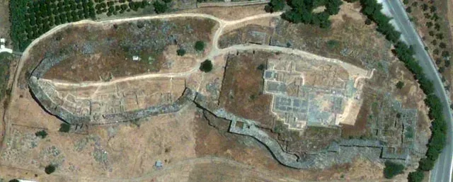
During the Late Bronze Age, Tiryns fortified hill gradually and surrounds within the “Cyclopean” walls of the palace complex and other buildings used primarily by the ruling class as places of worship, warehouses and workshops as well as residences. In historical times, Tiryns, although it should have been in the form of an organized political community, could not compete with Argos, which destroyed it, in the first half of the 5th century, exiling its inhabitants.
Pausanias, who visited Tiryns the 2nd century AD, found it deserted. During the Byzantine era in Upper Acropolis a funerary temple was founded and possibly a small class settlement in the west of the Acropolis. The end of the small longer settlement must be connected with the conquest of Argos from the Turks in 1379 AD. In Venetian sources, Tirynth was referred to as Napoli vecchio, while the name Tirynth was given again in the modern era replacing the usual name “Paleocastro.(old castle)”.
The investigations of the German Archaeological Institute and the Greek Archaeological Service from 1876 to present times, have unearthed major Mycenaean citadels, tracking stages of the culture of prehistoric and historic periods of Argolida prefecture. After the pioneers Heinrich Schliemann and Wilhelm Dorpfeld (1884-1885), the area was investigated in the first half of the twentieth century, by Georg Karo and Kurt Müller.
In the late 1950s, the Curator of Antiquities of Argolidos, Verdelis Nikolaos, undertook the restoration project on the west side of the fortifications which had collapsed and covered by the debris of old excavations. After 1967, the excavations conferred again in German Archaeological Institute, under the supervision of Ulf Jantzen, Jörg Schofer, Klaus Kilian and Joseph Maran continual research, including the Lower Citadel and the Lower City. At the same time, excavations are undertaken by the local Conservation Unity of Antiquity both at visited archaeological sites and regions.
The discovery of the excavations of a monument protected for centuries under the soil and long-term exposure without maintenance care to weather conditions and the actions of visitors caused significant damage to the archaeological site.
Through actions of D Conservation Unit of Prehistoric and Classical Antiquity Items, competent service of the Ministry of Culture and the direct support of the Peloponnesian Region, the monument were included in projects funded by the Second and Third Community Support Framework.
The participation of the German Archaeological Institute which funded the last decade studies of German architect Jan Martin Klessing implemented in Tirynth, was funded.
During this time, a large number of collaborators (archaeologists, designers, skilled and unskilled workers) participated in the program of upgrading one of the most important archaeological sites of the Argolida which is included in the list of monuments of world heritage of Unesco.
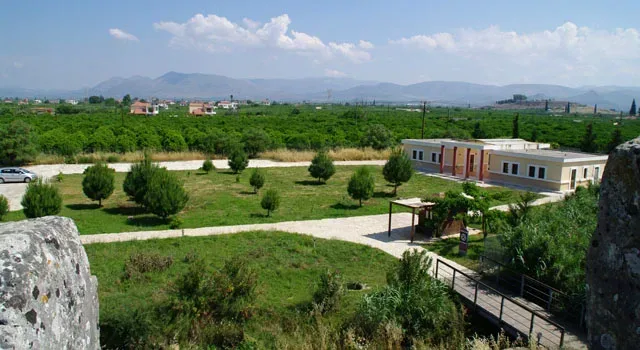
Besides the responsibility of the Directorate of Restoration of Ancient Monuments, Ministry of Culture implemented modelling works for the archaeological site, open to visit, which now includes organized routes, buildings convenience, new entrance and parking.
The Monuments of Area
Western Bastion
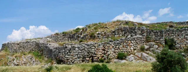
The Western Bastion is an outstanding achievement of Mycenaean architecture with a clear defensive character. The western staircase is protected by a bastion creating a sickle extension of the wall of the third phase. This section of the wall is the only one with curved outline. The maximum width is 7 m the curved section of the wall begins in the south at the height of the large yard and ends at the north tower which existed already in the second phase of the wall.
Οχύρωση Τίρυνθας
Fortification of Tirynth
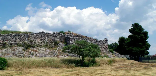
The walls bounding the citadel of Tirynth were built in three main construction phases and fortified gradually whole hill from the south-highest to lowest north-sixes. Red and gray limestone found abundant both on the same hill as the hill of Prophet Elias east of the citadel were used as a building material.
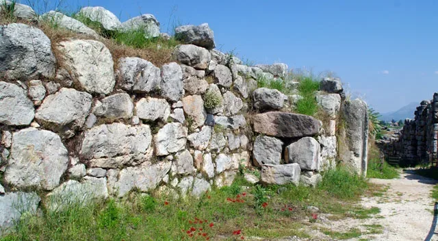
The size of the boulders which were mainly used for the walls of the third phase caused wonder and admiration to antiquity, which is directly reflected in the myth of the Cyclops. The boulders weigh several tonnes justifying the view of Pausanias (II, 25, 7-9) that neither pair of mules was able to move the smallest of them.
Lower Acropolis
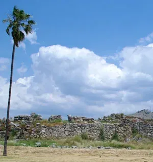
On the north and lowest elevation of the hill of Tirynth, the Lower Acropolis was fortified for the first time in the early 13th century BC (HR IIIV1). The fortification was replaced in the third phase of construction of the wall in the 13th century (Late Helladic IIIB2) by a strong wall thickness up to 7 m below the natural contours of the hill and extending south to the intersection with the fortification of the Middle and Upper Acropolis.
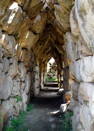
The Lower Acropolis connected through northern extension of the runway (50) with the Upper Citadel, but it also has two of its own access. A small entrance at the bend of the western side of the wall between the middle and lower citadel which was closed with a gate as traces of the hinges on the monolith threshold evidenced, and an opening in the top of the north wall untracked for a door. This opening is protected by a guardhouse on the eastern side of the wall which was much higher than the external level and the access to it must have been made possible with portable wooden scale. On the contrary, the entrance on the west side leads to an open stone staircase.
In the second half of the 13th century BC (Late Helladic IIIB2) after the completion of the fortifications, a huge construction activity grows, destroying the interference of the remains of earlier Mycenaean periods and Middle Helladic. The lower acropolis is formed into terraces and is built with a single plan. The buildings lined up along the walls are separated from the open walkways running north-south. A main road leads from the north gate to the south of Lower Acropolis and is associated with the runway (50) leading to the Upper Citadel.
Overall, ten building complexes were investigated (buildings I-X), which served as homes and also as laboratory facilities for the processing of metals and precious materials. Similar use is witnessed for rooms inside the wall.
Geometric Church
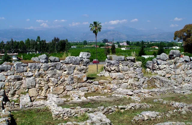
East of the gate that connects the courtyard 30 with the courtyard of the building 29 of the east wing of the palace, a pit – depositor was investigated in 1926, the so-called cesspit, which contained mainly pottery and a few metal objects. The oldest finds date back to the Late Geometric period and the newer around 650 BC, despite the fact that the majority of the offerings belong chronologically to the end of the geometric and sub-Geometric period.
The quality of the findings, include the clay shields and masks which are displayed in Museum of Nafplio, and their preservation, where most findings are crushed before disposal and bear traces of secondary combustion, arguing for its status as tributes. It is very probable that some of them were hung in a sacred space while others served for rituals probably at an altar space. The finding of the cesspit was associated for these reasons with the retrofit of the altar at the high court and with the elongated building that covers the eastern part of the great palace of the Mycenaean era.
So, it was considered that this building was a temple of the Geometric period, established at the Mycenaean Palace where people worshipped the goddess Hera. Unfortunately, the full revelation of this building ever since Schliemann period has deprived research from valuable archaeological evidence that could give a definitive answer to the still open question of the use and the dating of the building.
Dr. Alkistis Papadimitriou
Head of D Conservation Unity of Prehistoric and Classical Antiquitiy
More information about the archaeological site of Tiryns can be found on website of the Ministry of Culture and Tourism ODYSSEUS
Geographical Coordinates
Tiryns, Nafplio 211 00
- Google Map
- 37.60030833265785, 22.80133317136363
- 2752022657
For more information: EFA. Argolida, Syntagma Square, Tel: +30 27520 22657, e-mail: [email protected]
Palamidi
The fort of the Palamidi, which has been preserved in excellent condition, is one of the greatest achievements of Venetian fortification architecture.
The hill of Palamidi, which takes its name from the Homeric hero Palamidis, does not seem to have been systematically fortified until the second Venetian occupation. The construction of the fort was basically carried out during the time of Venetian General Superintendent of the Fleet, Agostino Sagredo, from 1711 to 1714, marking the fort not only as a major feat in terms of its fortifications, but also in terms of the speed with which it was constructed.
The engineers Giaxich and Lasalle designed a fort that was based on a system of mutually supporting and mutually defending bastions, which are built one above the other on a east-west axis, and are connected to each other by a wall. The total of eight bastions are self contained so that if one of them was breached, the rest could continue their defence.
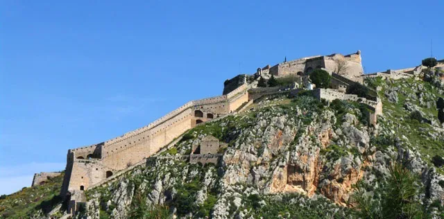
The central bastion of Aghios Andreas was the main headquarters and was the best equipped. The chapel of Aghios Andreas is located here. It was originally consecrated to St Gerardo, the patron saint of the Sagredo family. It should be noted that the names of the bastions changed according to the occupants of the fort. Apart from the bastion of Aghios Andreas, the Venetians also built: the bastions of Leonidas and Miltiadis to the north, Robert to the northwest, Themistocles to the south and Achilles to the east. The bastion of Epameinondas was completed during the time of the Turkish occupation, while Fokion was built entirely by the Turks. It should be noted that during the time of the Turkish occupation, Christians were not allowed to enter the fort.
It was from the Palamidi that the liberation of the city from the Turks began, after a long siege. On the night of 29th November 1822, a unit of Greek rebels, led by Staikos Staikopoulos, launched a surprise attack and seized the Palamidi. Dimitrios Moschonisiotis was the first to set foot inside the fort from the bastion of Achilles.
At noon on 30th November, once the debris had been hastily cleared away from the abandoned chapel, which had been consecrated to St Gerardo, a service of thanks and praise was held and the chapel has since then been consecrated to the Apostle Andreas, as his feast day is celebrated on this day; the day Nauplion became Greek.
From then on, every year on this date the liberation of the city is celebrated with a service in this historic chapel.
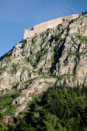
Not only was the Palamidi a great fortress, it was also the site of a dismal prison. In 1833, during the time of the regency, when King Otto was still a minor, one of the leaders of the revolution, Theodoros Kolokotronis, was imprisoned here on the supposed charge of high treason.
The Miltiadis bastion, one of the largest, was converted into a prison for serious criminals in around 1840, and it remained in operation until around 1926. The Aghios Andreas bastion was also used as a prison, but conditions here were somewhat better.
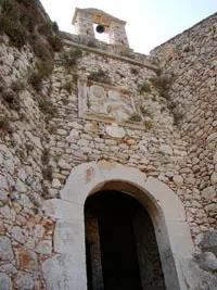
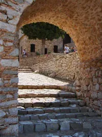
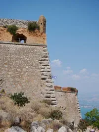
Today, the fort can be accessed either by the road which terminates at the eastern gate or by the famous steps which are located on the western side to the east of the Grimani bastion. These steps are traditionally supposed to number 999, the thousandth having been destroyed by Kolokotronis’ horse. However, in reality there are less and they were constructed during Otto’s reign by prisoners who were held in the Palamidi, under the supervision of the Bavarian army. From here there is an excellent view of the castle of the Acronauplia.
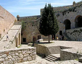
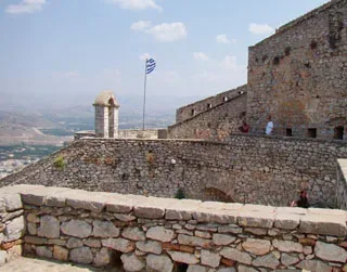
Once in the fort one can see, among other things, the imposing bastions, the historic chapel of Aghios Andreas and the impressive water tanks, which even today are used to collect rainwater.
Geographical Coordinates
Palamidi Fortress, Nafplio
- Google Map
- 37.562499066684765, 22.80501074463379
- 2752028036
City Hall
The renovated building in the Trion Navarchon Square, which today houses the town hall, has a long and interesting history. It is a two-floor neo-classical building, with a symmetrical façade topped by a gable.
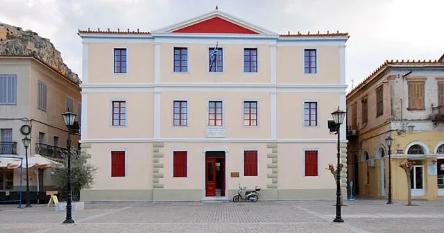
It was built in 1857 to house Nauplion’s High School, which was founded in 1833, during the time of King Otto.
The original High School had only two floors, but a third one was added in 1893 to house the Hellenic School. Then the High School moved to the second and third floors, while the Hellenic School was housed on the ground floor.
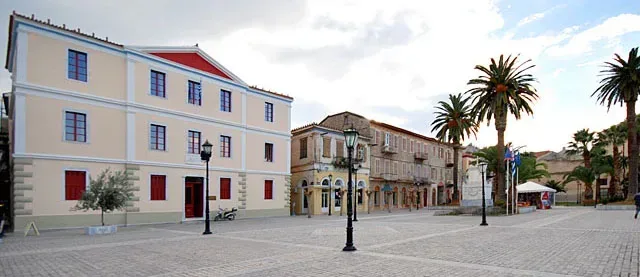
Nauplion High School was only the second building in Greece that had been specifically built to house a public middle school: the first being in Ermoupoli in Syros. Despite this, the school building had some imperfections: it was dark and did not have good ventilation. There was also no playground, but there was a garden to the front of the building, where pupils could sit during their breaks.
The building was abandoned in 1935, when the High School moved to the newly built building located opposite in Amalias Avenue. Since then, the building has undergone several changes in usage, until 1992, when it was renovated and now houses the Town Hall.
Geographical Coordinates
Three Admirals Square, Nafplio 211 00
- Google Map
- 37.5658547656677, 22.800363091239895
Vouleutikon
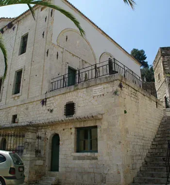
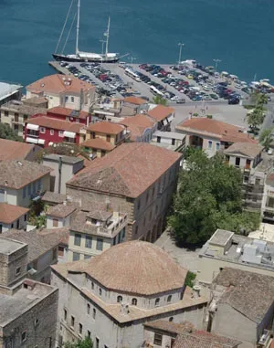
The Parliament building, which is located in the south-west sector of Syntagma Square, holds a special place in Greek history, as it was here that the parliament of the rebellious Greeks met.
It dates from 1730, the time of the second Turkish occupation of the city, and was originally built as a mosque. It was built in ashlar masonary and consists of a square chamber with a large dome. It is a characteristic mosque of the late Ottoman architectural period, with its heavy proportions and bulky dome. To the west there was once a domed portico, but this fell down during an earthquake at the beginning of the 20th century.
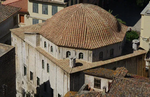
According to local tradition, this mosque was built by a rich Turkish Aga in order to redeem his soul from a heinous crime that he had committed: the Aga had killed two young Venetians who had come to Nauplion to find the treasure that their father had hidden when the city was occupied by the Venetians. The Aga found the treasure following the map that was in the possession of the two men, but he killed them in order to keep the loot for himself. Later, filled with remorse for his hideous crime, it is said that he used the gold he had stolen to build the large mosque in the square, which became known as the mosque of Aga-Pasha.
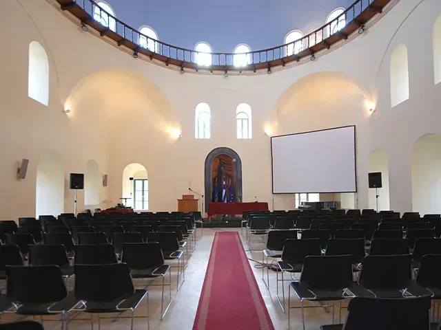
After the liberation of the city from the Turkish yoke the mosque was used to house the Greek Parliament, from the autumn of 1825 to the spring of 1826, after suitable remodelling by the architect Vallianos. This was its most important use, and the name of ‘Vouleftiko’ or ‘Parliament’ has remained in use to the present day.
As with many of the most important buildings in the city, with the passing of time it has been used for a variety of purposes.
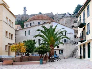
In 1831 it housed the Greek School for a short time, while the ground floor was used as a prison. During the time of Kapodistrias and Otto, from 1828 to 1834, it was here that public dances were held. In 1834, during the regency period, the trial of the chiefs of the Greek revolution, Theodoros Kolokotronis and Dimitrios Plapoutas, was held here.
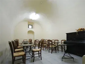
Today, the Parliament has been exemplary restored by the Ministry of Culture and serves as a meeting place, where, in addition to conferences, most other cultural events take place.
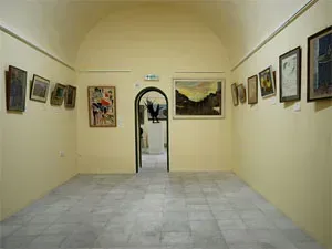
The Municipal Art Gallery of Nafplio with an interesting collection of paintings by contemporary Greek and Greek artists was recently moved to the ground floor of the Parliament building. The works are donations mainly from the Potarian Group of Nafplion and the Nafplion Nikolaos Karagiannis.
Geographical Coordinates
The Parliament Building, Nafplio
- Google Map
- 37.56589190083003, 22.796255346411865
Bourtzi
The fort on the sea, which has remained known by its Turkish name ‘Bourtzi’, meaning tower, has become Nauplion’s trademark.
On this small island, which is in the middle of the city’s harbour, there was once a Byzantine church consecrated to Aghios Theodoros.

The Venetians, having understood the strategic importance of this site for the protection of the port, built a tower on the rock in 1473. The Italian architect, Antonio Gambello, who had undertaken the building of the Castello di Toro, designed the fort, which was then completed by the engineer Brancaleone.
The fort was designed to fit the narrow shape of the island. The centre is taken up by a tower, in the shape of a rough hexagon, with covered cannon positions on either side at a lower level.
The interior of the castle has three floors which were connected by moveable stairs for reasons of safety. Water was supplied from a large circular water tank that was located in the cellar, under the tower.
There were entrances to the north and south. A small harbour was created on the north-eastern side to enable safer access to the fort.
Between the fort and the sea wall there was a narrow passage, which could be closed with a chain to protect the port from enemy ships.
The fort bears the signs of many alterations and repairs from different times.
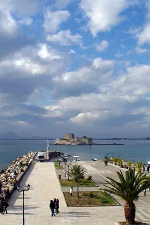
The Turks surrounded the fort with the so-called ‘porporella’, in other words an undersea barricade of stones to make it impossible for large ships to approach.
In the 18th century the Venetians proceeded with additions to the Bourtzi. They raised the height of the central tower and almost the entire island was covered with defensive positions.
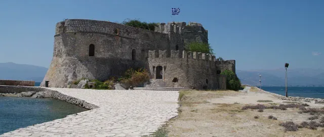
During the time of the Greek revolution, the Bourtzi was known as Casteli or Thalassopyrgos, sea tower. It was here for a short while in 1826 that the Greek government sought shelter, when the rebellious nation fell into civil strife.
The Bourtzi was active as a fort until 1865. It then became the place of residence for the executioners who carried out the death sentences on the prisoners in the Palamidi.
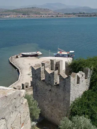
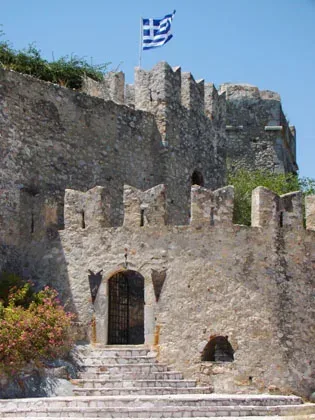
In 1935 it was turned into a hotel after alterations by the German architect Wulf Schaeffer. Today one can visit the Bourtzi by boat from the seafront.
Departure point (boats) for Bourji

Geographical Coordinates
Bourtzi, Nafplio
- Google Map
- 37.569872878302014, 22.79041320872223
- Σημείο αναχώρησης για Μπούρτζι (καραβάκια)
The Customs House
Little of the history of the old customs house, which is located on the coast road, is known to us. It is estimated that it was built around the middle of the 19th century by the architect Stamatios Kleanthis. He is best known for his urban plan of Athens, which he designed in cooperation with Eduard Schaubert, and his designs for various public buildings in the same city.
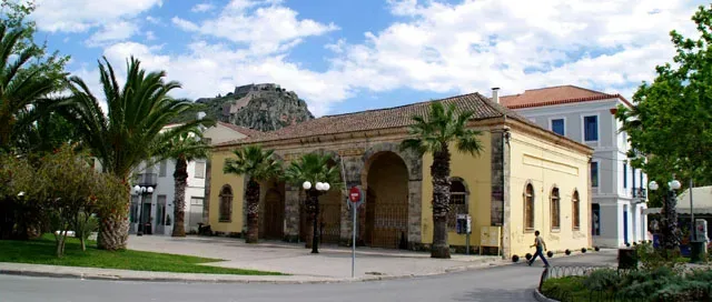
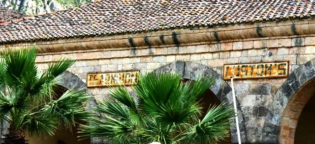
The façade of the Customs House is in three parts with an arcade supported on pillars, recalling the Venetian Arsenal in Syntagma Square, which seems to have been the inspiration. Generally the Customs House is simple in design, rectangular, with symmetrical entrances and windows. It creates a sense of balance and harmony, in keeping with the neo-classical movement.
Geographical Coordinates
Customs, Nafplio
- Google Map
- 37.57161789850656, 22.805139363178753
The “Trianon”
During the time of the second Venetian occupation, the mosque was used for Catholic worship, and has been identified, with some degree of certainty, with Saint Antonio of Padua. It was donated by the Venetian General-in-Chief Francesco Morosini to the Franciscan order in 1687, when the city was occupied by the Venetian Republic.
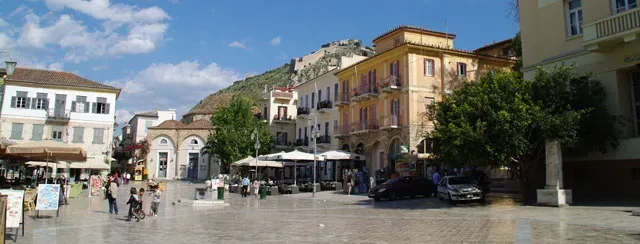
From 1828 to the beginning of 1833, the ‘Allilodidaktiko Boys School‘, was housed here: the name means that in this school teaching was carried out by the most competent students, the so-called ‘Protoscholoi’ or monitors.
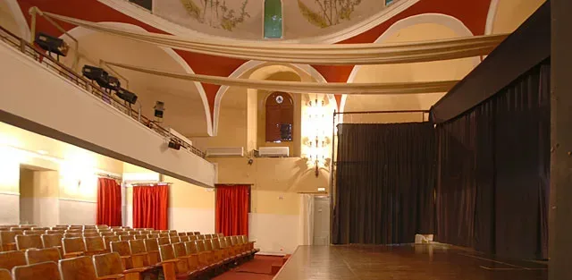
Later, at the end of the 19th century, the building was used as a theatre; while in 1915 the interior was remodelled, degrading to a certain extent its original appearance.
For many years the ‘Trianon Cinema‘ was here, while more recently the old mosque has housed the Nauplion Municipal Theatre.
The exact location of the Triannon can be found below.
Geographical Coordinates
Trianon, Nafplio
- Google Map
- 37.56591454802759, 22.7973263163136
Kolokotronis Park
The centre of the park is dominated by a monumental statue on horseback: the hero of the Greek revolution, Theodoros Kolokotronis. It is one of the most important works of neo-Hellenic sculpture and was created by the Tinian sculptor Lazaros Sochos in Paris.
It is made of a copper alloy and is placed on a monumental stone pedestal. The ‘old man of Moria’, as Theodoros Kolokotronis was known, is depicted on horseback, holding the reins in his left hand and showing the way forward with his right. The whole work is impressive and the proud form of Kolokotronis exudes an air of greatness.
The cost for the acquisition of the statue was exceptionally high, and a nationwide appeal was necessary to raise the funds. It was moulded in 1894 at the Thiebaut foundry in Paris and in 1895 it was transported to Greece. The pedestal, a donation from the appeal court judge, Nicholas Kotsakis, was designed in Paris by the brothers Tiero and was constructed in 1900 in Athens at the marble workshop of Ioannis Chaldoupis.
The statue was unveiled in 1901. A similar statue, by the same artist, can be found in Athens in front of the old parliament building.
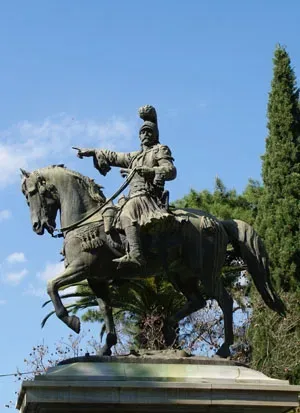
Theodoros Kolokotronis, one of the most important figures in the Greek struggle for freedom, lived in Nauplion for many years, as did many of the well-known wartime leaders. In fact he was given a house in Syntagma Square, as well as land near the entrance to the city, in the modern Argous Street, together with the Chapel of Aghii Theodori, which survives to this day.
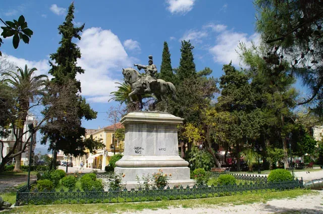
The exact location of Kolokotronis Park can be found below.
Geographical Coordinates
Kolokotronis Park, Nafplio
- Google Map
- 37.566050055417804, 22.802207132444273
The Lion of Bavaria
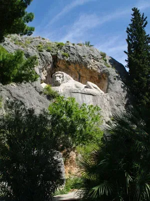
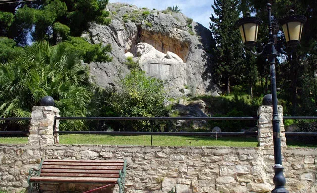
On Michael Iatrou Street between the church of Aghii Pandes and the modern graveyard, the visitor will find an exceptional sculptured monument, one of the most important of 19th century Greece; known as the lion of Bavaria, which dates from 1840 -1841.
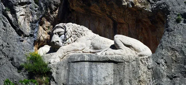
The lion, which is carved into the rock on a monumental scale, seems to be sleeping. The sculptor of this beautiful monument was the German, Christian Siegel, who was the first professor of sculpture at Athens Polytechnic. The model for the work was the Lion of Lucerne, by the famous Danish sculptor, Bertel Thorwaldsen.
Below the lion there is an inscription in German that informs us that this monument was commissioned by Ludwig of Bavaria, father of Otto first King of Greece, in memory of the Bavarian soldiers in Otto’s escort who died during the typhoid epidemic in Nauplion which devastated the area between 1833 and 1834.
The Bavarians were buried in the graveyard of Aghii Pantes and in an area north east of Evaggelistria which became known as the ‘Bavarian monuments’. Later, their bones were exhumed and were taken to the crypt of Nauplion’s Catholic Church.
Today, the area in front of the Lion of Bavaria has been turned into a small park with benches, to provide a place to rest during a tour of the city.
Geographical Coordinates
Lion of Bavaria, Nafplio
- Google Map
- 37.56642854589997, 22.811366589621937
The Acronauplia
The rocky peninsular of the Acronauplia comprised the walled settlement of Nauplion from ancient times until the end of the 15th century.
The Acronauplia walls bear witness to its rich history, which it must be confessed, is a little difficult to follow, due to its long uninterrupted inhabitation. The current form of the castle, although quite changed by modern intervention, basically crystallised during the Frankish and first Venetian occupations from the 13th to 16th centuries.
Evidence of a pre-historic settlement has been found, and on the west side, a section of the ancient polygonal walls from the 4th century BC has survived. There are also remains of the walls from the Hellenistic and Byzantine periods.
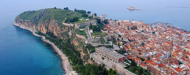
From 1210-1212, when the Franks invaded the city, they divided the Acronauplia into two enclosures that they called castles. More or less in the middle of the peninsular was the Castello dei Franchi, which was built to house the Frankish leaders and became the administrative and military headquarters of the city; while the Castello dei Greci, in the western sector, further up, was built for the Greeks.
The Castello dei Greci must have existed during Byzantine times while the Castello dei Franchi must have been built a little later. The Franks built a wall between the two castles and a square tower in the middle of the hill, to control communication between them. In the eastern wall of the Frankish castle there was a gate protected by two circular towers and a triangular fort. This gate was decorated with interesting murals and became known as the ‘Gate of Peace’.
During the first Venetian occupation, and more specifically in 1470 during the command of Vettore Pasqualigo, the Venetians, threatened by Turkish raids, proceeded with repairs and extensions to the fortifications of the Acronauplia, under the supervision an important engineer of the time, Antonio Gambello.
One of the first and most important projects was the addition of a new enclosure, the so-called Castello di Toro, below and to the east of the Castello dei Franchi. The name probably comes from the Italian word ‘torrione’, which means a large tower adjoining the walls of a fort.
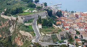
The Castello di Toro is still in good condition today and, after climbing the steps from the Catholic church, one can admire the imposing round tower with its crenellations, which protects the city gate; an excellent example of late renaissance style.
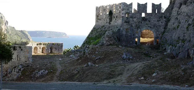
Another work from the time was the so-called Traversa Gambello, which was designed to protect the Castello dei Franchi by the building of a second transverse wall between it and the Castello dei Greci. The gate between the two castles was reinforced with a polygonal bastion and a semi-circular wall with crenellations.
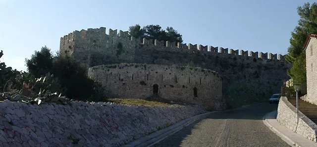
During the years of the first Turkish occupation, there were only a few re-enforcements and additions made to the castle, which was known by the Turks as Ich-cale, in other words the interior castle. It was inhabited by ordinary citizens, Turks and Christians, as the officers’ residences had moved to the lower city.
In 1686, when the Venetians seized the city from the Turks, they ordered that there was to be no habitation of the castle. Those who were resident there would be moved to the lower city, which had been created using artificial banks at the end of the 15th century. The Acronauplia was from then on only to be used by the military.
In 1829, Ioannis Kapodistrias, the governor of Greece, created a large barracks and a military hospital on this site.
In 1926, the infamous prison was transferred from the Palamidi and housed in the barracks created by Kapodistrias. In 1937 these prisons also became civil and operated there until about 1960.
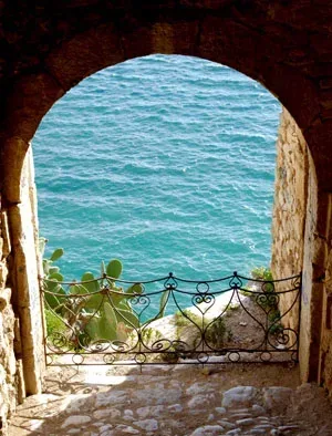
The demolition of the prisons began in 1970-71 in order to construct the ‘Xenia Pallas’ hotel, which involved the destruction of a large section of the walls and buildings of the Castello dei Greci. At the same time, Kapodistrias’ military hospital was also demolished. The only thing that remains of the hospital is the chapel of Aghii Anargiri.
Today, one can visit The Acronauplia climbing east from Staikopoulos Park through Arvanitias Square, or climb the steps from the Catholic church through the Castello di Toro.
The exact location of the Castle of Acronauplia can be found below.
It should be noted that the three enclosures of The Acronauplia can be seen best from the Palamidi.
Geographical Coordinates
Castle of Acronauplia, Nafplio
- Google Map
- 37.56454124535887, 22.793213998756162
The Courthouse
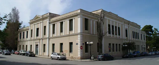
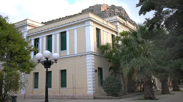
The Courthouse, built with donations from the great Greek benefactor, Andreas Singros, was completed in 1911, from plans by Anastasios Stamatiadis. Today the appeals court is housed in the building, which was constructed in the neo-classical style.
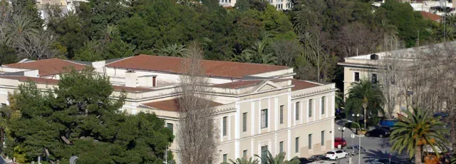
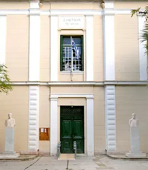
The entrance is decorated with the busts of Anastasios Polyzoidis and Georgios Tertsetis, two great figures, who served the Greek judicial system with exemplary consistency. Both have remained in history for their firm stance during the trial of the leaders of the Greek revolution, Theodoros Kolokotronis and Dimitrios Plapoutas, when in 1834, during the time of the regency, they were accused of conspiracy.
Both the president of the court, Anastasios Polyzoidis, and one of the judges, Georgios Tertsetis, refused to sign the warrant condemning the two to death. Both were removed from the bench for their stance, but were later vindicated and returned to their judicial duties.
In the southern section of the courthouse square there is a monument to the hero of the Greek revolution who became known as Nikitaras. Nikitas Stamatelopoulos, as he was really called, was a superb soldier. In fact, for a while he was in command of the siege of Nauplion.
The monument to Nikitaras was erected in 1926 by Aspasia Potamianou, on the wishes of her husband, the Nauplian politician, Elias Potamianos, and it takes the form of a memorial stone. At the base there is a relief design of a battle scene in which Nikitaras kills a Turkish cavalry man with his knife. The sculptor who designed the piece was Antonios Sochos, the nephew of Lazarus Sochos, who created the statue of Kolokotronis. Sochos seems to have been inspired by a mural by Peter Von (H)Ess, which depicts Nikitaras during the battle of Dervenakia. On the reverse side of the monument there is an engraving of verses from a poem by the Greek poet, Kostis Palamas, dedicated to Nikitaras.
Geographical Coordinates
6 Andreas Syngrou 6, Nafplio 211 00
- Google Map
- 37.56560717278881, 22.800899255570965
The Armansperg Residence
This is one of the most important mansions from the reign of Otto to be found in Nauplion. The building originally dates from the second Venetian occupation, but it was rebuilt in 1831 and the second floor was added.
The house was home to the president of the regency, Count Joseph Ludwig von Armansperg, during 1833 and 1834. Armansperg was a highly controversial personality, and he has remained best known for the conspiratorial and autocratic nature of his policies.
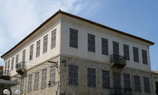
According to witnesses of the time, the house was one of the largest in the city and the interior decoration left nothing to be desired in comparison to the greatest houses in Europe; it hosted receptions and balls with rare, for the time, musical accompaniment on the piano.
At one time, directly opposite the Armansperg residence, there stood the residence of Georg Ludwig von Maurer, the vice-president of the regency.
Geographical Coordinates
Plapouta 35, Nafplio 211 00
- Google Map
- 37.5659183421402, 22.802632586155987
The Grimani Bastion
The bastion, named after the Venetian commander, Francesco Grimani, was built in the north-eastern corner of the Castello di Toro.
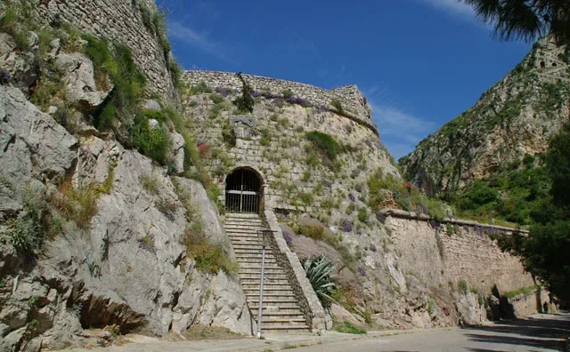
Construction began in 1702 and was completed in 1706, as part of the reconstruction work on the eastern wall of the lower city during the second Venetian occupation.
The Grimani or San Antonio Bastion had 4 cannon positions which protected the Acronauplia and the narrow road which led to the Land Gate.
The bastion is four-sided and the lower part has been built with large stones that stick out in the so-called rustic style. The stones at the higher level have been laid in a more even order.
On the north and east walls, the trade mark of Venetian fortifications stand out: the statue of the winged lion of Venice, the symbol of the city’s patron saint, Mark the evangelist.
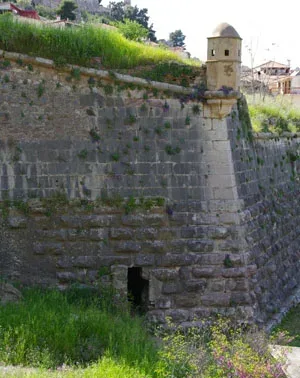
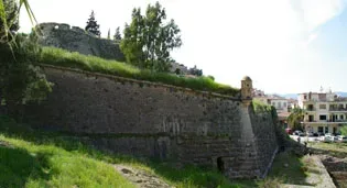
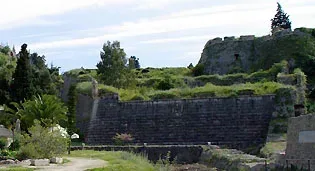
The bastion is still in good condition and is visible from the Land Gate and Staikopoulos Park.
Geographical Coordinates
Nafplio 211 00
- Google Map
- 37.56420638056504, 22.800628334386612
The Bastion of “Pende Adelphia”
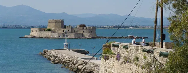
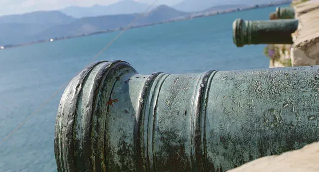
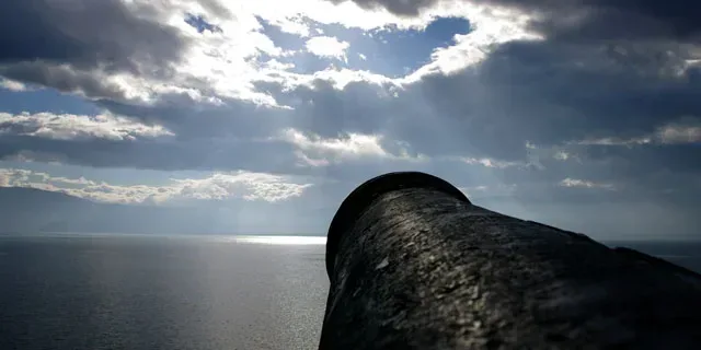
The Bastion of “Pende Adelphia”, or Five Brothers, is the only bastion to escape demolition and survive to the present day. It is on the North West slope of the Acronauplia and owes its name to the five cannons, all the same size, that reinforced its defences.
This bastion protected the western section of the lower city and the harbour, in combination with the Bourtzi. It was probably constructed by the Venetians at around the end of the 15th century. According to some researchers, it must date from later, during the time of the Turkish occupation, as the construction demonstrates some roughness and lack of skill.
Geographical Coordinates
Nafplio 211 00
- Google Map
- 37.56540854603372, 22.793241377473095
The Land Gate
The Land Gate was built in 1708, by the French engineer, and succeeded the earlier gate dating from the first Venetian occupation. It was the only entrance to the city by land and, in fact, the gate would be closed at sunset. Whoever remained outside after that time was obliged to spend the night outside the city, usually in the Pronia suburb. In front of the gate was a moat filled with seawater, which ran along the eastern wall of the city. Access was only possible via a wooden drawbridge.
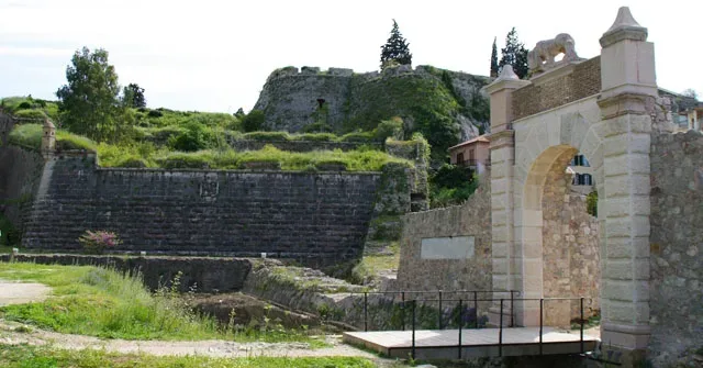
The gate was gradually demolished between 1894 and 1897. In around 1894 the moat was also filled in.
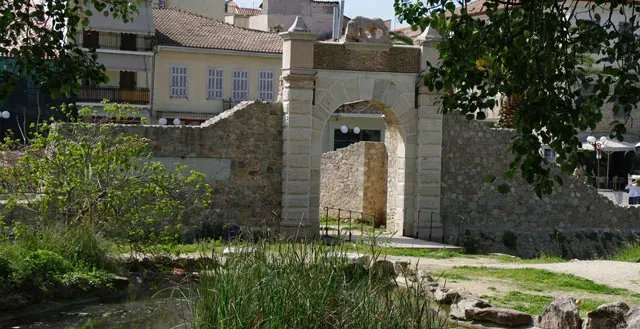
Only a few of the gate’s architectural structures have survived, such as the stone lion from the crown, which is missing the head, the wings and the tail. There is also the family crest of the commander Grimani, with the date 1708.
Today, the façade of the gate has been reconstructed following a special study of its original form.
Basically, the structure of the gate is simple: an arch with two pillars on either side; while at the highest point there was a statue of a lion, the symbol of the Venetian state.
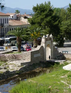
Near to the left-hand pillar there is a plaque, which has been inlaid into the wall, commemorating the liberation of the city by the Venetian general-in-chief, Francesco Morosini in 1687.
Geographical Coordinates
Andreas Syngrou & 25th March, Nafplio 211 00
- Google Map
- 37.56489040694022, 22.80084942442059
The Sagredo Gate
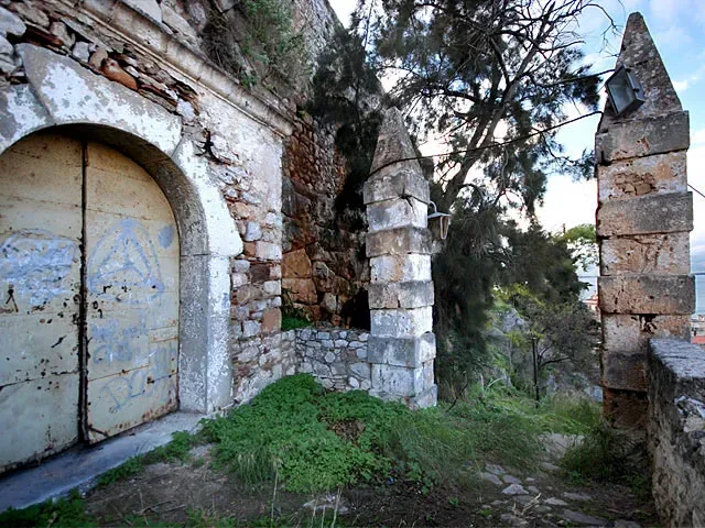
This gate takes its name from the general superintendent of the fleet, Agostino Sagredo, and dates from 1713, the time of the second Venetian occupation of the city.
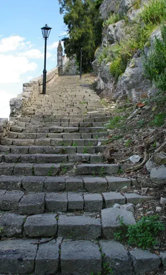
According to the inscription decorating the gate, Sagredo designed the gate in order for soldiers to have easier access to the lower city from the castle on the Acronauplia, by means of a short road.
It should be remembered that from 1686 civilian habitation had been prohibited in the castle, which since then had been used solely as a fort, and occupied only by military personnel.

Geographical Coordinates
Sagredou Gate, Nafplio
- Google Map
- 37.5651611419184, 22.795649082084676