Welcome to the churches and monasteries of Nafplio, a world dedicated to spirituality, religious heritage and tranquility.
Here, faith and art coexist, offering a unique visiting experience. The churches and monasteries of Nafplio reflect the spirituality and faith of the region. By visiting these sacred places, you will discover the architectural beauty and art related to religion. You will have the opportunity to explore the historical monuments and sacred sites that highlight the faith and spirituality of the region.
In addition, visiting these sites gives you the opportunity to learn more about the history of religion in the region and the importance of sacred sites to the community. It is a journey into the world of religious heritage and spirituality that is worth experiencing.
Metropolitan Church of Aghios Georgios
The Metropolitan Church of Aghios Georgios is one of the most important and oldest churches in the city, and many great events from Greek history took place here.
It is believed to have been built at around the beginning of the 16th century, during the time of the first Venetian occupation of the city, but after the invasion of the city by the Turks in 1540, it was turned into a mosque.
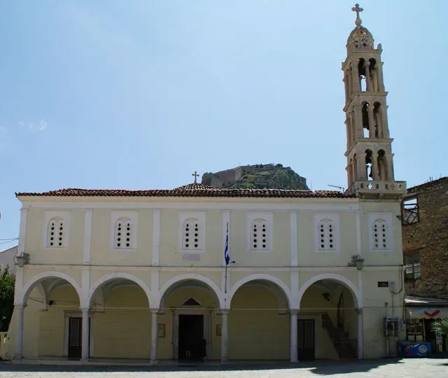
In 1686, when the Venetians successfully retook the city from the Turks, the church of Aghios Georgios was the site of the reception for the victorious commander-in-chief, Francesco Morosini, and a service of thanks was held here. During the second Turkish occupation, the church was once again turned into a mosque, and after the liberation of the city in 1822, Aghios Georgios became Orthodox.
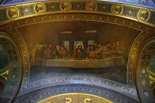
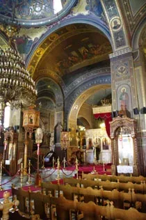
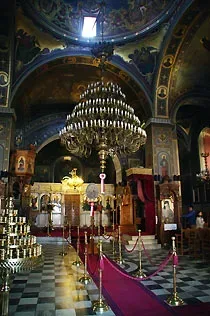
The church is built in the basilica style, with a dome and murals that must have been created during the second Venetian occupation, around the beginning of the 18th century, in a western style. In fact, the depiction of the Last Supper is a copy of the well-known composition by Leonardo da Vinci. In 1823 the murals were re-painted by Dimitrios Vyzantios, the author of the famous ‘Babylon’.
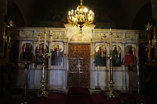
The funerals of many famous figures from the Greek revolution were held in Aghios Georgios; such as Palaion Patron Germanos or Dimitrios Ypsilandis, who was actually buried in the narthex of the church. It was here, amidst great solemnity, that the funeral service of the murdered Greek governor, Ioannis Kapodistrias was held. His embalmed remains were placed in the vestry for about six months, until 29th March 1832.
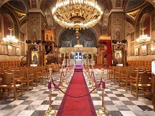
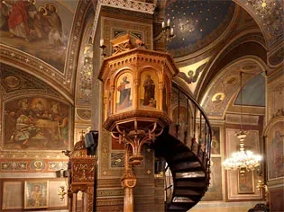
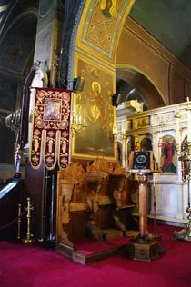
It was to the church of Aghios Georgios that Otto, the first King of Greece, came on 25th January 1833, as soon as he landed in Nauplion. Today, the throne where the young Otto sat during services can still be seen.
The narthex and bell-tower were added in 1834 by the regent who ruled until Otto came of age, in order to commemorate the king’s arrival in the city. It was at this time that Aghios Georgios became Nauplion’s Metropolitan church.
South of the church there is a very important building that dates from the time of the first Venetian occupation, as does the church itself. It is two-storey and surrounds the church in an ‘l’ shape. In around 1712 it must have housed the Venetian Religious School, while during the 19th century the building had various uses, such as a printing press, or an orphanage. We know that in 1824 it housed the Ministry of Education and, in 1830, the Hellenic School.
There are houses in Aghios Georgios Square which demonstrate the austere elements of early neo-classicism. Every summer there are concerts held here as part of the famous Nauplion Festival, which is successfully organised by Nauplion City Council. Apart from Aghios Georgios Square, concerts are held at other beautiful sites around the city, such as the bastion of Aghios Andreas at the Palamidi; the Bourtzi and Arvanitias Square.
Geographical Coordinates
Metropolitan Church of St. George, Nafplio
- Google Map
- 37.56852212939232, 22.79886373843098
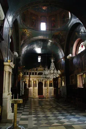
The Church of Aghios Spyridon
Construction on the Church of Aghios Spyridon was completed in 1702, during the time of the second Venetian occupation of the city, funded by the Nauplian Brotherhood of Orthodox Greeks. It is a single nave church with a dome.
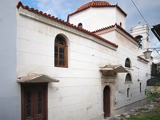
It was here, outside this church, that one of the blackest events in modern Greek history took place. At dawn of 27th September 1831, Ioannis Kapodistrias was murdered by the Maniatian brothers Georgios and Konstadinos Mavromichalis.
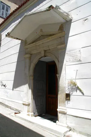
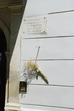
Kapodistrias was on his way to church, as was his habit every Sunday, to Aghios Spyridonas, which was consecrated to the patron saint of his birthplace, Corfu. At the entrance to the church, however, the two assasins were waiting for him, and, after they had greeted him, they attacked; Konstadinos Mavromichalis with a pistol, Georgios with a knife. The governor died instantly. Konstadinos Mavromichalis was chased and lynched by the furious crowd, while Georgios was executed a few days later.
The grief resulting from the death of the governor was great. His embalmed body was laid out in the Governors Mansion for many days for people to come and pay their respects, and his funeral was held on 18th October 1831 in a sombre ceremony in the church of Aghios Georgios. His internal organs were placed in an exquisite casket under the altar of Aghios Spyridonas.
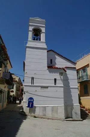
Geographical Coordinates
Holy Church of Agios Spyridon, Nafplio
- Google Map
- 37.56547949194468, 22.79807391921919
The Church of Panaghia
The Church of Panaghia, consecrated to the Presentation of the Virgin Mary, is one of the oldest and most beautiful churches in the city.
The original church, which dates from the 15th century, to the time of the first Venetian occupation, was smaller and belonged to the Orthodox Church.
In around 1700, during the time of the second Venetian occupation, the church took its current form, a three-aisled basilica.
The interior has a beautiful wooden chancel in the eptanisian style and was created in the 19th century.
The pulpit and bishop’s throne are also in the same style. The narthex is a later addition, while the bell tower dates from 1907.
The Church of Panaghia also celebrates the memory of Aghios Anastasios, the Patron Saint of the City.
Every year, on 1st February, the saint’s feast day, there is a great procession of the icon of the protector of the city.
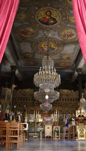
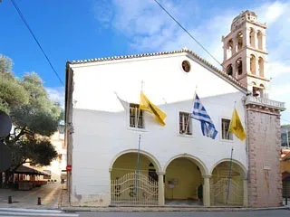
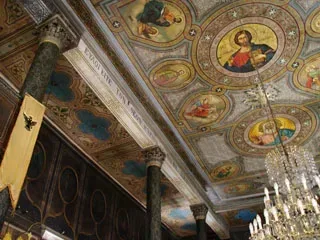
Today, the Church of Panaghia, is a favourite pilgrimage site for visitors to the city and is well known for the procession which takes place on Good Friday, and winds through the narrow streets of Psaromachalas to the sounds of the choir chanting the eulogy.
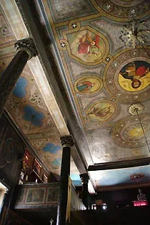
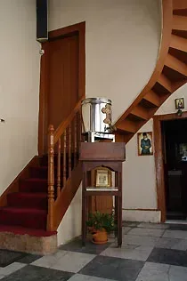
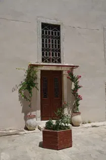
The exact location of The Church of Panaghia can be found below.
Geographical Coordinates
Holy Church of Panagia, Nafplio
- Google Map
- 37.566823524318195, 22.795747626453487
The Church of Aghios Nikolaos
The church of Aghios Nikolaos, the patron saint of sailors, was built next to the port, in one of the most beautiful parts of the city.
According to the inscription on the foundation stone, the church of Aghios Nikolaos was moved from inside the walled city to the shore on the wishes of the Venetian superintendent of the fleet Agostino Sagredo, in 1713.
Sagredo chose this site, outside the city walls and next to the sea, as the church was dedicated to sailors.
The modern church of Aghios Nikolaos must be more recent and was consecrated in 1836.
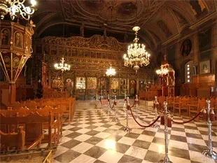
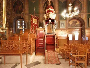
The church is in the basilica style, with a flat roof, known as ‘the heavens’, which is common to Italian style churches.
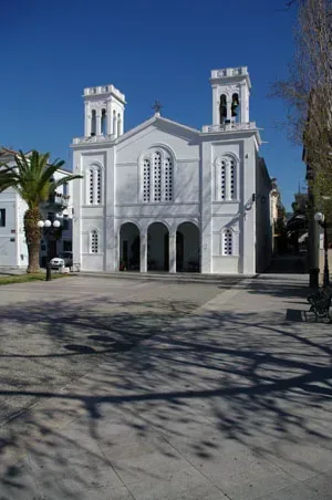
Today, it is well worth seeing the carved wooden chancel with its pulpit; the large despotic icons, which date from 1848 to 1849, as well as the central chandelier from Odessa and the bishop’s throne. The façade and bell tower are later additions to the church
Geographical Coordinates
Nafplio
- 37.567019134980114, 22.79671687399197
The Monastery of Aghia Moni (Aria)
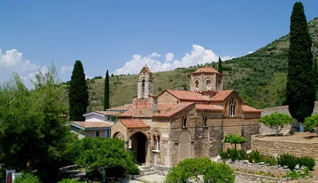
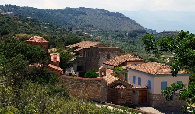
The Monastery of Aghia Moni is close to the suburb of Areia, 3 kilometres north east of Nauplion. The Katholicon of the Monastery dates from around the middle of the 12th century and since 1875 has been dedicated to Zoodochos Pighi, literally, ‘the source of life’
It is one the most important churches of the middle Byzantine period and is in excellent condition.
According to its foundation inscription, which was inlaid into the exterior wall to the right of the main entrance, the church was built with donations from the Bishop of Argos and Nauplion, Leo, who had it constructed in 1149.
The church is mainly of architectural interest, as the original paintings and decorations have not survived.
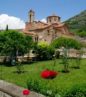
The architectural type of church is a cross-in-square of the four columned type with dome; and forms, along with other churches of 12th and 13th century Argolis, a special group in the Greek school of Architecture.
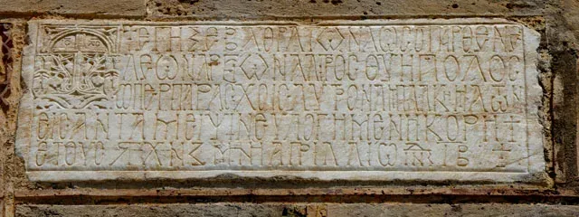
The other churches, which are within a short distance on the Argolian Plane are: The Dormition of the Virgin in the village of Chonika; Aghia Sotira in Plataniti and The Dormistion of the Virgin in the village of Merbakas or Aghia Triada.
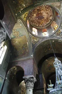
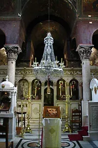
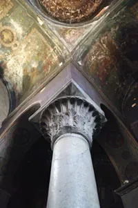
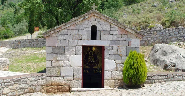
Just outside the grounds of the monastery is the monastic spring, which is famous for its water. Some identify this spring with the ancient Kanathos, which was mentioned by the 2nd century AD traveller Pausanias.
Today, the Monastery of Aghia Moni is a women’s retreat and is under the auspices of Bishopric of Argolis.
Geographical Coordinates
Agia Moni, Nafplio 211 00
- Google Map
- 37.56392898067583, 22.83229308650673
- 2752027764
The Monastery of St Demetrios Aygou (Iria)
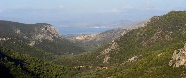
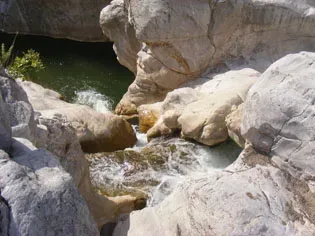
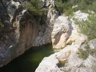
Over the plains of the region of “Iria”, on the north of the mountain “Aygo” or “the Egg”, probably owing to its shape or some technique for ground measurements, lies the monastery, closely knit with the river “Rados”, which can be sailed, should one wish to reach the monastery from its liquid route. Alternatively, the route is through the village, called “Pelei”, which as in the first case point, it leads to a rugged gravel road, straight to the sanctuary.
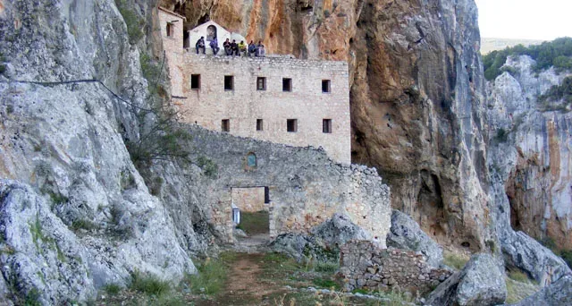
Much has been said, rumors have been cast, and stories have been woven by locals, who have propagated with the passage of time, regarding both the steepness of the place as well as its nickname, “Aygo”. Initially, it has been alleged that the decision for the church’s erection had been made for another area, yet, St. Demetrios, himself had designated the current position as the orthodox one. Construction workers given the green light to assemble in the former place would see their tools mysteriously transported to the latter, divinely determined one.
The term “Aygo” is claimed to have been defined so due to early Christians of the period to upright confirmation of the monastery’s setting, which is why they threw an egg to see whether it would crumble and crumble it did not. This rather awkward technique was decisive for the formation of the church. There is also this assumed story of a mother, according to the locals, who had a dying child so she turned to Virgin Mary for help and prayed she did. It seems that she had a vision of Virgin Mary ordering her: “show me your belief by throwing your child off the cliff and it shall heal itself”. The woman then thought about throwing an egg off to see if it would shatter and it did not. She threw her baby and it got killed.
However the closest to reality notion of the term “Aygo” or “the Egg” appears to be deriving from the etymological approach it has in the Greek language, meaning “bare top”.
No bibliographic notice of any kind has been recorded other than the previous telltales, which quite logically have been enhanced or weakened with the passage of time, regarding the date of the church’s assembly. The one and only true deduction can originate from the stonework of the body of the church, nave and aisles’ construction made of brick, leading to its formation somewhere around the 11th to 12th century.
The main site of the monastery, deep inside the rocky cavity, is divided into a ground floor and two floors above it, connected with a narrow stone step ladder. On the second floor lies the body of the church, nave and aisles, consisting of a two-nature sanctuary, one dedicated to St. Demetrios the Holy Myrrh Scented and the other one to St. Theodoroi. Sadly, the interior of the former temple has been fire burnt and destroyed.
The fire damaged the woodcut icon screen of the church as well as its frescoes. Now both temples communicate through a bilobed opening, which must be mural-painted around the 17th century, about the same period the church of St. Theodoroi has, ensuing the finger-counted few paintings that have survived.
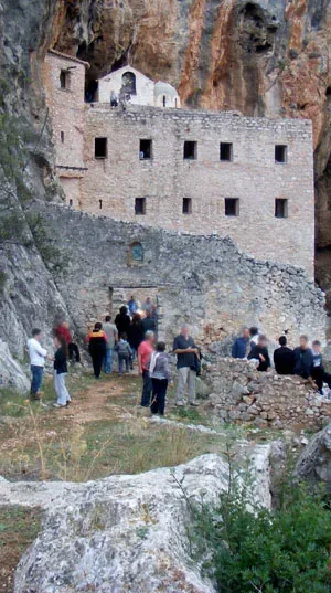
Over the body of the church, nave and aisles, on the monastery’s roof is a stone-made step-ladder leading to the dome (eight-angled Athenian type one) and the roof (a pointed, cone one) of the second temple. The view of the plains of “Iria” is absolutely breathtaking.
The underground part of the monastery seems, based on records to have accommodated at around 1700: sixteen (16) monks and that many servants, 127 horses, 3000 sheep, 800 goats etc. Considerable is the contribution of the monastery and particularly of its Reverend Father, who took an active part on the wage on the town of Nafplio. (The scattered debris of the region around the monastery as well as its architectural style attests to its fortress-like nature). In 1833, the monastery was home to a “Father”, three servants and [….].However, the records were destroyed alongside the monastery itself, ‘washing away’ almost all mysteries of its activity throughout the years.
Presently, the monastery is left abandoned and derelict. As the residents of the region of “Iria” sadly point out, being among the few to try to preserve the monastery: “It is a pity to lay no protection or consideration on such a memorable monument”.
Geographical Coordinates
Epar.Od. Nafplio – Trachea
- Google Map
- 37.504939797743184, 23.126452934201858
The Monastery of St. Theodosios (Panariti)
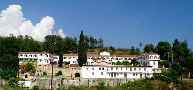
For the citizens of the prefecture of Argolida, this Monastery holds a spiritual, religious significance. It rests just outside the region of “Panariti”, roughly 3km away;
it was erected back in 880 AD by the obscure, unknown monk Theodosios, who, later on, was sanctified. Following his Assumption (922AD), the Abbey was left deserted and came back to life in early 16th century.
In the beginning of the Venetian reign, the “Chortatsi” Cretan family, friends to the Venetians, were granted the administration of the Abbey, until it was finally devolved to the property of the Greek Estates, in 1835.
The recorded year of 1942 seems highly important, since the Abbey was administered to nuns and thus, became a nunnery.
Since then, the nuns have contributed and conscientiously performed their duties, involving themselves in charitable and spiritual causes, while catering for the harmonious coexistence of the complex with the surrounding, environing it.
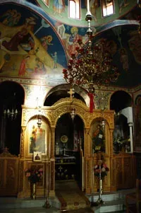
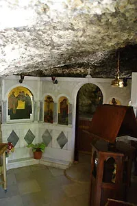
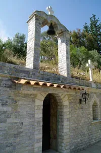
That said, the Abbey boasts a remarkable building structure, composed of churches, guestrooms and nun-solitary chambers. The first chapel to come across commemorates “The Sacred Summon”; a meeting of St. Theodosios with his contemporary St. Peter. Tradition makes mention of a miraculous event in the course of the “meeting”, when St. Theodosios welcomed St Peter, holding his hood filled with burning coal, much like a censer, a thurible, without getting burnt, whatsoever.
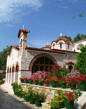
The “Katholikon” shadows the complex’s centre in an impressive way. Speculation of it being Byzantine has yet to be confirmed, possibly owing to the fact that it has undergone sweeping changes and deformations within the years.
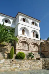
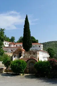
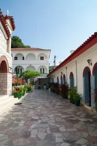
The “Catholicon” (else written) is comprised of two churches, one dedicated to the founder, St. Theodosios, (with an adjoining wall-painting of the saint) and the second one, celebrating “The Transfiguration of the Christ”. Let it not be forgotten that the visitor can also look at the chapel, memorializing John the Baptist.
On the Monastery’s south lies the hermitage of the saint, which has become a church, in honor of the Holy Cross.
Geographical Coordinates
Panariti, Midea 210 55
- Google Map
- 37.630100913310194, 22.86031052899629
The Catholic Church of Metamorphosis Tou Sotiros
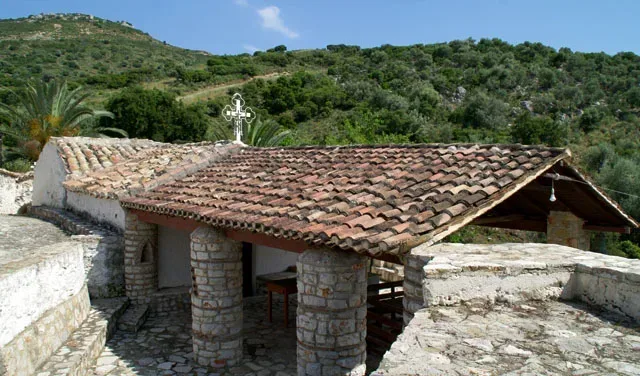
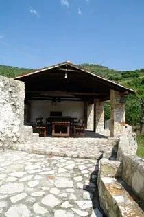
Next to a three-floor dilapidated tower, on the south of the region of Assini, lies the “Katholikon” of the Abbey. Almost all of the adjoining buildings alongside the tower have been torn down, manifesting a landscape of desertion. The outpost itself assumes great importance, during the reign of the Venetians, since from its top the cove of “Karathona” is clearly seen.
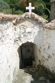
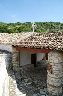
The sanctuary is built 90cm above ground, reclining level, so the visitor will have to climb up 6 (six) steps to enter the Abbey.
The interior of the temple is possibly frescoed during the meta-Byzantine period, despite the coating on parts of the walls.
The dedicatory sign mentions that the sanctuary was mural-painted in 1570, so it can be deduced that the Abbey must have operated prior to that date.
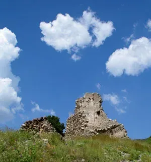
The monastery has kept on performing its liturgical services till 1834, with two monks residing there. Currently, the Abbey is a private one, but still visitable.
Geographical Coordinates
The Transfiguration of the Christ Abbey (Assini), Asini
- Google Map
- 37.52931841387523, 22.83928417227617
The Monastery of St.Demetrios “Karakalas” (Ag. Andrianos)
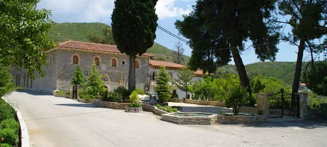
The Monastery, built really close to the region of “Agios Andrianos” and at the foot of the mountainous village of “Arachnaio” was also called “Xsirokasteli” (stressing the –ste-syllable), yet rarely has it been used by the locals. Now, the “Karakalas” term or nickname has been translated by the Turkish word of “Kurukule”. The corruption of the word by the locals has brought it to its present sound. This explanation, among others, seems to be the most plausible, regarding the root of the name.
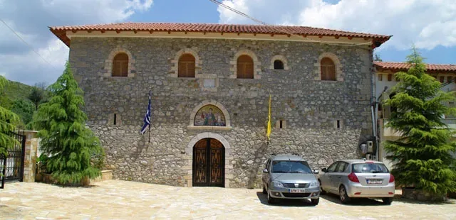
There is no exact date of the erection of the Monastery, though since 1696 there is a description of its massive property. This is probably the theory towards the assumption that the nunnery was up and running for centuries.
During the wage to reclaim the town of Nafplio from the Turks, the nunnery stepped in actively, supplying the rebellious cause with weaponry. Records point to the fact that the sanctuary was run by a Father Superior (Dionysios), six monks and fifteen (15) wage earners in 1829.
The present day “Vouleutiko” building (Old Parliamentary House) is said to have been the place where the Turks erected their “temenos” (place of worship) out of the preserved material left, after the nunnery sustained huge fire damage at the beginning of the 19th century.
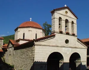
ΤIn 1928, the Monastery was expropriated and was divided to local shepherds, to have their livestock graze. “Karakalas” Monastery also suffered two merges, one in 1934 with the Monastery “Talantiou” and the other one two years later, in 1936, with the “Agnountos” and “Michael and Gabriel” Nunneries. Unfortunately, the German forces set the church ablaze in 1943 and blow up one of its compartments, during the German Invasion, WWII. It was in 1963 that it became a MOnastery and commenced a new period of affluence.
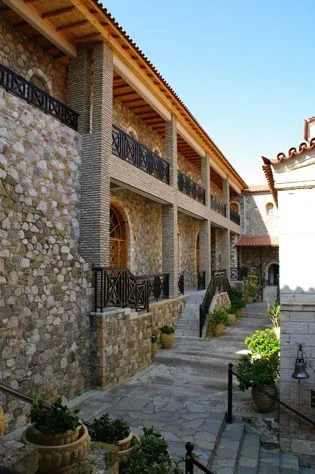
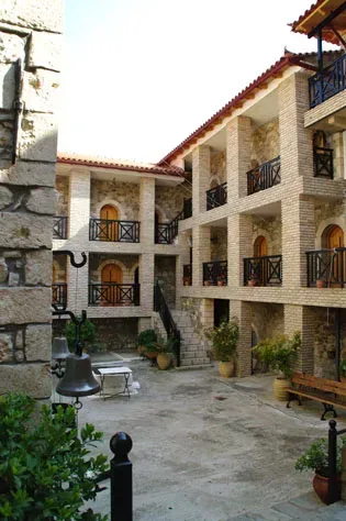
The Public Record Office renders it known that the Monastery had a fortress-like style; a sprawling complex, which could self-guard, if need were. The Nunnery’s chambers have got an interior orientation and are lushly decorated with arches and roofed verandahs. A number of churches have emanated within the lines of the Monastery, them being: “St. Paraskevi Holy Church”, “St.Irene the Chrysovalantou”, “Virgin Mary the Portaitisa Holy Church”, “St. Nektatios Holy Church” and “St. Efraim of Syros island Holy Church”.
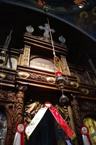
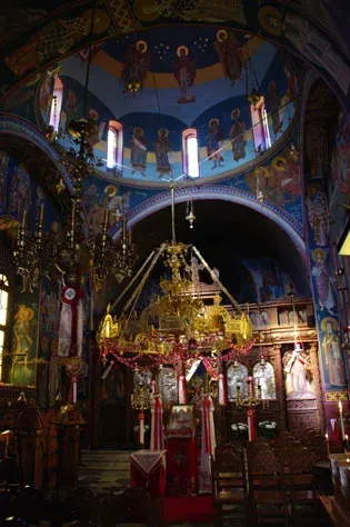
The center of the Abbey glows in its “Katholikon” with the measurements 19 x 8m, being rebuilt in 1871. The “Katholikon” is characterized architecturally as a registered cruciform domed one. The curve of the arches is followed by a tiled decoration. The interior mural painting is a courtesy of X.Voulgaris. Striking awe awaits the visitor who observes the wood-curved iconostasis and the 18th-19th century icons exhibiting Virgin Mary and St. Demetrios.
Currently (2011), the nuns, under the guidance of Mother Superior or abbess, seek to retain the strength and face of the Monastery.
Geographical Coordinates
Moni Karakala, Agios Adrianos, Nafplio
- Google Map
- 37.62085907302362, 22.908075705211306
The Church of Aghia Sophia
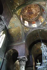
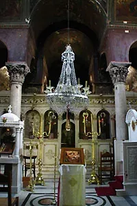
Climbing the steps from Lambrinidou Street in the picturesque Psaromachalas neighbourhood, one comes to one of the oldest surviving churches in the city, the small single nave domed chapel, which is consecrated to Aghia Sophia.
It is not beyond the realms of possibility that its construction dates back to Byzantine times, if we judge from the architectural elements that have been constructed in the Byzantine style.
When the Turks conquered the city in 1715, Christian churches were forbidden to operate within the walls of the city; the only church in which services were allowed was the church of Aghii Pantes, in the Pronia neighbourhood.
Somewhere between 1779 and 1780, Hassan-Pasha granted Aghia Sophia the right to hold Christian services for Christians living within the walls, after the intervention of his Greek interpreter, Nicholas Mavrogenis.
From then on, it was the only Christian church inside the walls that was allowed to hold services.
After the liberation of Nauplion from the Turkish yoke, Aghia Sophia was renovated in 1825 with funds donated by the Provost Marshal of Nauplion, Nasos Photomaras.
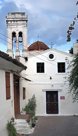
The exact location of the Church of Aghia Sophia can be found below.
Geographical Coordinates
Holy Church of Agia Sophia, Nafplio
- Google Map
- 37.56575588159233, 22.796710089408826
The Church of St. Sotiria (Anyfi)
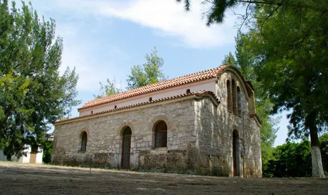
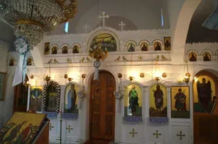
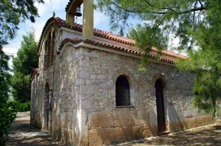
Not much can be said, document-wise, about this church. It is dedicated to the Ascension of the Christ, or “Agia Sotiria” in native Greek. It rests on the main route connecting the village “Anyfi” with that of “Neo Ireo”.
Its architectural basis is a one piece basilica, whose roof has been renovated some years ago. Clear evidence suggests the building of the church above ancient ruins, since its stonework has been mannered with big, rectangular stones.
Geographical Coordinates
Antifi 210 55
- Google Map
- 37.65867559446512, 22.788869643398073
The Church of St. Andrianos and Natalia (Agios Andrianos)
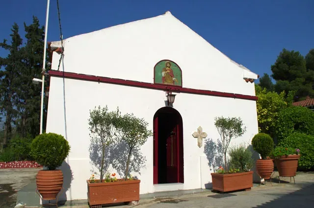
The chapel of St. Andrianos, located in the verdant hill of the region Agios Andrianos, was probably erected prior to 1743, when it was also icon-painted. A document, written and sent to the Venetians in 1696, mentions the existence of the chapel and remains the most tangible proof of its erection prior to 1743.
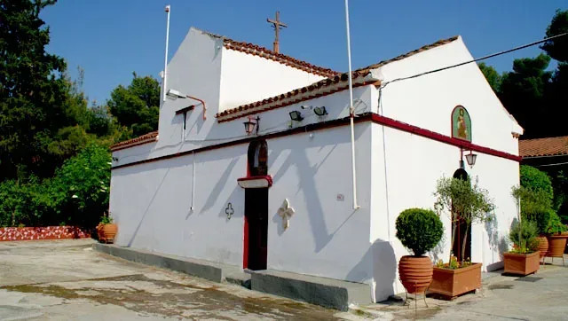
Yet, rising rumor among the village’s elders speak of an inscription on the walls dated back to 1400. This theory cannot be confirmed, since the chapel has undergone two fire blows, destroying the recorded dates on the sign. Another element to support the theory is the 1743 establishment date, inscribed on an icon, among others. Attention-grabbing is also the fact that the chapel’s floor is made of stone. St. Andrianos small church is architecturally a cruciform temple.
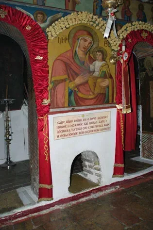
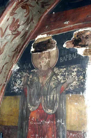
St. Andrianos, the holy protector of the adjacent village (earlier called “Katsigkri”), which has been named after him, honoring his name and his sanctity, is regarded miraculous and gathers a crowd of faithful followers from across Greece.
Next to the chapel’s attractive doors lies a hole with a telltale surrounding it. Upon first glance, one may understand that only the size of a small child could pass through it. However, to date, all those to have ventured passing through it, have managed so, problem-free, irrespective of size or weight. It is alleged that going through that opening is good for anyone visiting the chapel. This hole, aperture is known as “the passage of the stout, possessing faith”
Geographical Coordinates
Agios Adrianos, Nafplio 211 00
- Google Map
- 37.60022044401025, 22.86239691161399
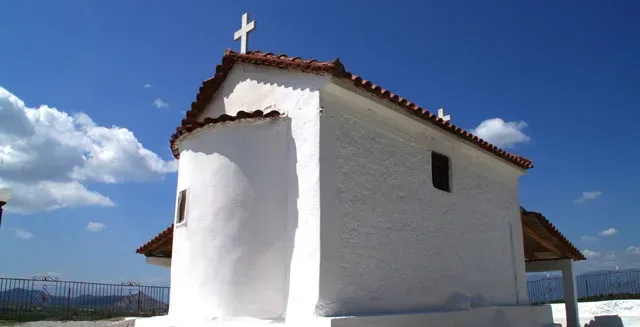
The Church of St.Thomas (Manesi-Dendra)
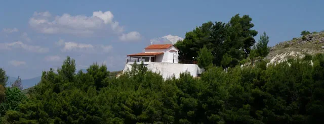
The village named “Manesi”, and particularly the “Dendra” settlement may well boast for the small church dedicated to St. Thomas, out in a piney hill. Speculation has it that the present foundations of this church were the home of either an ancient temple dedicated to some Greek divinity or some stronghold, a fortress perhaps of “Midea” village.
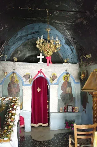
The chapel is architecturally considered a basilica one, yet due to its coating, more information pertaining to its dry masonry has actually been shred. Nonetheless, the wall murals on the interior are themselves stimulating and still they have not been age-determined.
On the sanctuary’s right, a small opening can be observed, which is locally regarded miraculous.
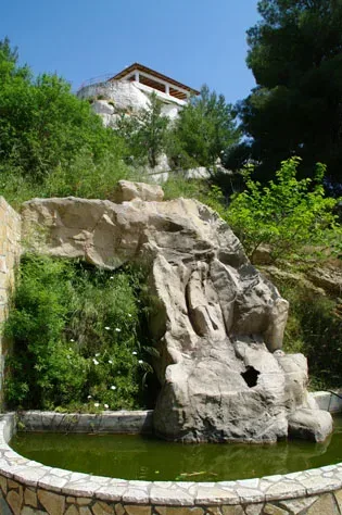
A designated churchyard, just below the chapel, surrounded by pine trees has been made for the visitors’ relaxation. Springing water from the rocky surface is also a must, much like an “oasis”, especially during the summer hot months of the Greek climate.
It is worth noticing that the view of the plains of Argolida prefecture is quite breathtaking; a sight for sore eyes for those paying a visit to the chapel of St. Thomas.
Geographical Coordinates
Nafplio – Prosimni, Nafplio 210 55
- Google Map
- 37.65426785390955, 22.835044481132048
The Church of St. John (Lefkakia)
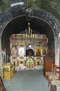
On the south side of the village “Lefkakia” springs this place of worship, a chapel, built on a small hill. Theories of it being erected on the tops of ancient fortress ruins of Argos or Ancient Assini have not been verified, for little information is gathered.
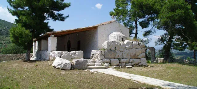
It can be chronologically placed during the reign of the Turks in the Greek territory and as far as its architecture is concerned, it is a basilica structure with a tiled roof.
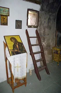
The chapel’s interior is an icon-painted one, but little is known of the artist or the date.
Tradition has it that sick children are transported through a window on the north side, something considered miraculous.
Geographical Coordinates
Holy Church of St. John, Lefkakia
- Google Map
- 37.56049072799598, 22.850224057963576
The Church of St. John Crysostom (Pirgiotika)
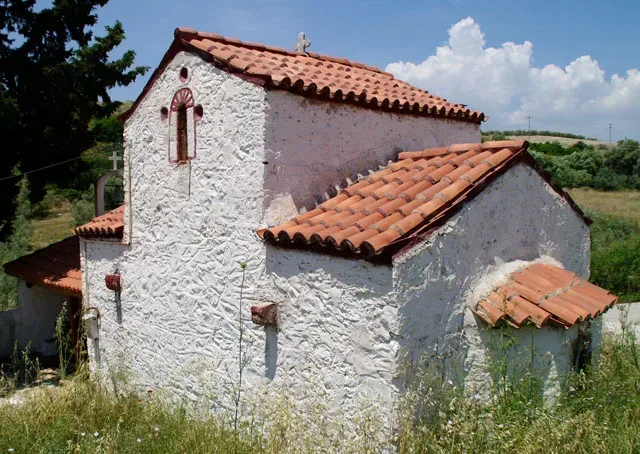
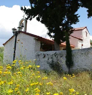
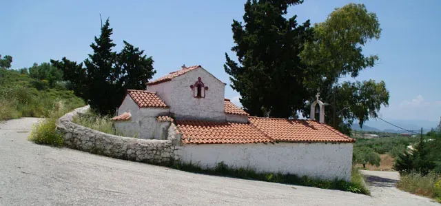
The cross-shaped St. John Chrysostom’s chapel can be located outside the village “Pirgiotika”, particularly on its northeast, approximately 4 (four) kilometers away from the village’s centre.
The exact time of its assembly or the manner of its stonework cannot be determined, due to the coating on all the walls.
On the interior however, there are fragments of old murals, artistically created by members of the Cretan School.
The exact location of the church can be found below.
Geographical Coordinates
Holy Church of St. John (Pyrgiotika)
- Google Map
- 37.59973440112468, 22.891852068171126
The Church of St John the Theologian (Midea)
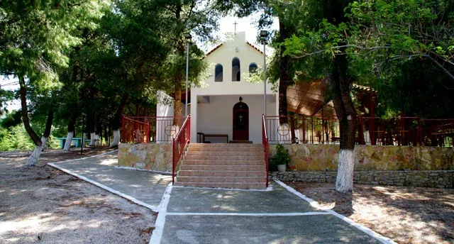
Even though the region’s dwellers insist on claiming that their area has seen the building of a rather sprawling monastery, there is indeed no factual evidence to support that claim, nor is there any written documentation on its existence.
Tradition supports that in the exact location of the chapel, once stood a three hundred (300) monk monastery, which according to the elders, had played a vital role during the Turkish reign, becoming the shelter and treatment stage for the “enemy’s warriors”. For all that it is worth though; the surrounding area is filled with tiled and stone debris, which might attest to the existence of a settlement there.
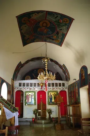
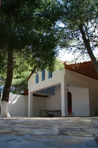
The chapel is a small basilica, architecture-wise, with a tiled roof and two main entrances. The sanctuary is a hemispherical one and its interior has been decorated with paintings as well as a number of icons.
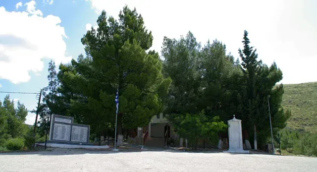
The chapel’s yard also holds a marble inscription to commemorate the victims of war following the German invasion in World War II.
Geographical Coordinates
Holy Church of St. John the Theologian (Midea)
- Google Map
- 37.67579538653491, 22.874855357895264
The Church of St. Nicolas Church (Iria)
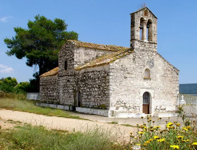
Supposedly, one of the oldest churches in the prefecture of Argolida, this church’s actual date of assembly is not confirmed. However, the west side of the church, just above its entrance has the inscribed date of 1381.
Bibliographic documentation recognizes this church as the predominant one of the prefecture in 1696.
It was built in the type of the composite four-conical cross-shaped inscribed church with a dome and, together with other churches of the 12th and 13th centuries of Argolis, it constitutes a special unit in the context of the Greek School of Architecture.
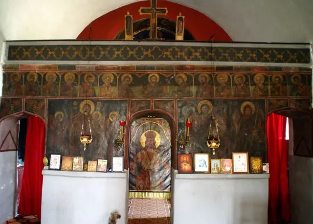
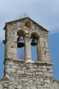
The campanile of the church is quite noteworthy with a part of it being architecturally capital. The church’s interior has been frescoed some time during the second period of the Venetian domination.
The cross shaped, basilica structured church of St. Nicolas lies in the north of the region of “Iria” next to the debris of a tower, and it is also used as the church’s cemetery for that region.
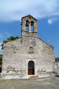
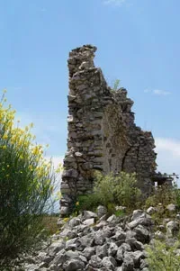

Outside the precinct of the monastery is the monastery’s spring, famous for its water. Some identify this spring with the ancient Kanathos mentioned by the 2nd century AD traveller. Pausanias.
Today, the Agia Moni is a women’s retreat with 6 nuns who look after the monastery and its surroundings.
Geographical Coordinates
Iria 210 60
- Google Map
- 37.50807387697737, 23.013794821722744
The Church of St. Nicolas (Poulakida)
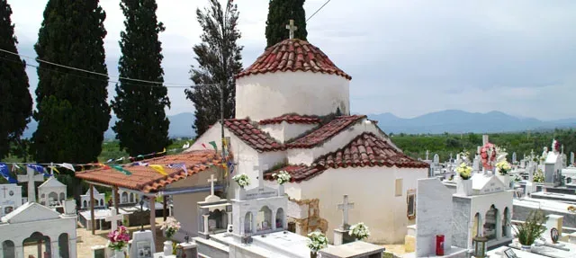
Heading north, away from the village’s centre square, one comes across the church of St. Nicolas which also happens to be the township’s cemetery.
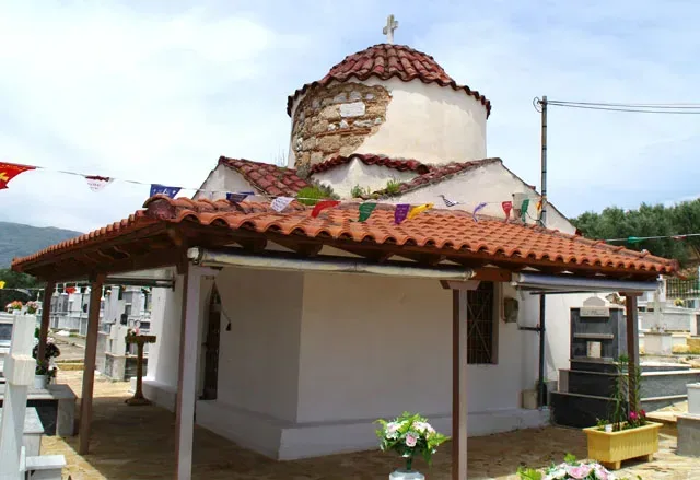
This church can be architecturally characterized as a registered cruciform temple, whose key attribute is the supersized dome.
However, the artistic manner of its buildup cannot be analyzed further, due to the coating on the walls.
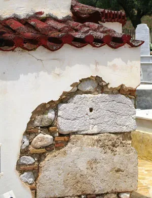
The one and only part of the wall’s paint which has been removed, clearly points to the assumption that ancient stones as well as Byzantine-era materials have been used for its erection.
Noteworthy is the fact that there is a badly-preserved inscription stating that this house of God underwent renovations in the year 1829.
Geographical Coordinates
Poulakida, Nafplio
- Google Map
- 37.65336119276834, 22.813622577593044
The Church of St. Theodoroi (Manesi- Dendra)
There seems to be a scarcity of evidence in modern day bibliography regarding this church. The source to have shed some light is one, dating back to 1853, referring to the church as a nunnery, well-abandoned at the time. Nevertheless, the style, the artistic technique of the temple allows room for speculation as far both its erection and usage are concerned.
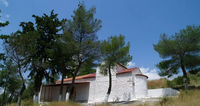
The architectural schematics bear resemblance to another Byzantine church in the prefecture of Lakonia, St.Nicolaos, in the region of Agoriani, dating back to the later parts of the 12th century.
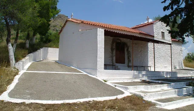
The church’s dimensions 4.6 x 9.1m (including its sanctuary) is cruciformed, tiled roofed and presented without any dome. During the later years, an antenave was added with a wooden roof. Built in plain masonry while at the same time the windows being tiled decorated, suggests that it has been a structure used within the course of Turkish rule. The church can be accessed only from the south gate.
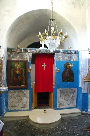
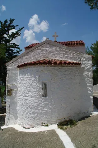
While the chapel’s interior should have been all icon-painted, the coating allows for a few, if any, spots of religious murals to be manifested.
The chapel lies in the foot of ” Palaiokastro”, just outside the region of Midea, a term used by the elders for the acropolis of the village and of the broad expanse of Ancient Midea.
Geographical Coordinates
Manesis – Dendra 210 55
- Google Map
- 37.65645401115177, 22.827088454821812
The Church of Aghii Pandes
The historical church of Aghii Pandes, which is found in the Pronia suburb, on a side street off Michail Iatrou, is built in the natural rock of a small hill.
Its existence is known from the time of the second Venetian occupation. In 1715, when Nauplion was invaded by the Turks for the second time, Aghii Pandes was the only church in which Christians were allowed to worship, until 1780, when worship was also allowed in Aghia Sophia, a church located inside the city walls.
Surrounding the church was the old city graveyard, where several of the great personalities of the Greek revolution have been interred such as: Palaion Patron Germanos, Nikitaras and Staikos Staikopoulos.
This graveyard was operational until about 1852, when the modern one was built.
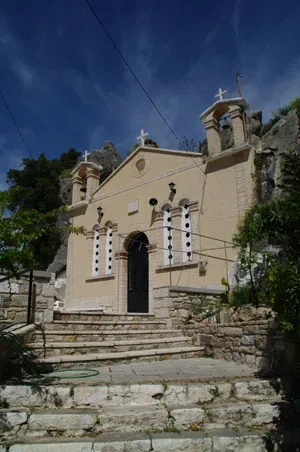
Today the visitor can see tombstones from the old graveyard in the floor of the church and the steps leading up to it.
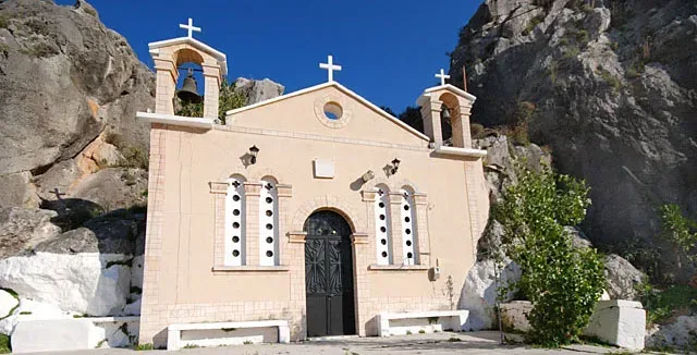
The exact location of The Church of Aghii Pandes can be found below.
Geographical Coordinates
Holy Church of All Saints, Nafplio
- Google Map
- 37.565898099909994, 22.811400062003173
The Church of The Annunciation of Virgin Mary (Argoliko)
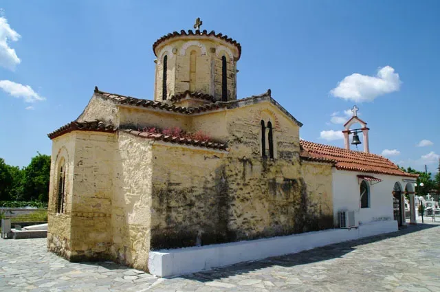
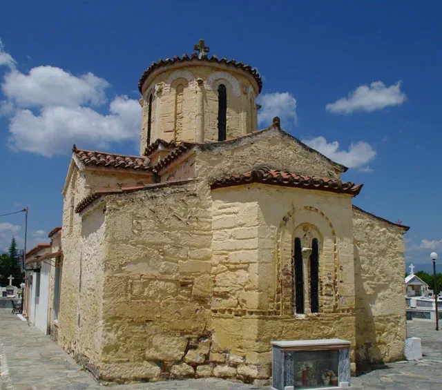
The church is located in the rural community formerly known as “Koutsi”, now “Argoliko”. Evidence is short as far as its historical classification is concerned, aside from a report by “vicar Nicolaos” to the Venetians, stating that the church has been fully functional since 1969.
It has also been serving as the village’s cemetery. Architecturally, it can be categorized in the registered, cross-shaped domed one. There has also been a structural annexation on the west side of the church.
The exact location of the church can be found below.
Geographical Coordinates
Holy Church of the Annunciation, Argoliko
- Google Map
- 37.61996347585106, 22.798037181496852
The Church of the Assumption of Virgin Mary (Agia Triada)
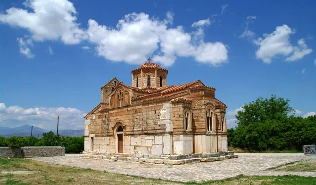
It is supposed to have been one of the most significant Byzantine temples, during the period of the Comnenians, both for the prefecture of Argolida as well as the whole of Greece. It still holds some morphological similarities with the church of “Agia Moni” in Nafplio, which immediately creates an association between the two. The location in which it is built was named “Vouzi”, but presently utterly forgotten or unspoken of by the residencies.
There seems to be much speculation surrounding the exact date of the church’s erection with the most prevailing one among scholars being either at the end of the 12th century or the early 13th one. The temple’s frescoes are placed at a period around the end of the 13th century or even at the dawn of the 14th century; however they could have been created much later than the actual assembly of the temple itself.
The Latin Bishop of Corinth Willen Van Moerbeke, Dominican, orientalist and philosopher had resided for a number of years in the monastery, after having been anointed as a bishop by Pope John the 21st, in 1277. The mention of Moerbeke’s name and acts is apparent among many French historians, who describe him as a wonder scientist of his time. Perhaps the alternative, native name of the village, “Merbakas”, is so, honoring his name.
During the reign of the Venetians, the church is conceded to the Bishop “Hortatsis” of Rethymno, Crete.
Between the years 1715-1770- the last period of Turkish reign- the church’s management is granted to the metropolitan Bishop of both neighboring towns, Argos and Nafplio.
Circumstantial to none is the recorded information gathered for the following years, regarding the fate of the cloister. It seems to have been structurally around in 1833, without any monks or cells whatsoever.
Eventually, the area surrounding the monastery and the temple was trodden underfoot.
Still, to date, there are but a handful of locals, who know the existence of the church or its active role throughout the centuries, from the moment it had been built.
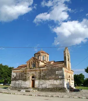
For quite some years, the churchyard had been used as a cemetery of the township “Agia Triada” or in translation “Holy Trinity”, yet with the cemetery removed, concerted efforts have been made to restore the area as well as the church itself and provide accessibility to any visitor.
The Assumption of Virgin Mary Church stands at the entrance of the village, following the route from Nafplio.
The church has such measurements (15, 67×8, 45) and is potentially built upon ancient grounds, seeing that the church counts a number of tombstones, fragments of marble and ancient Greek dwelling stones.
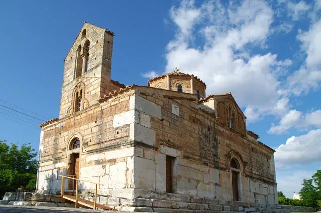
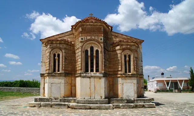
Praiseworthy is the combination and the theme exchange of ancient material, decorative elements and Byzantine flair on the outside of the church. Architecturally, it is a complex cruciform temple, four-columned, including a dome. It has got four entrance-exit gates and its windows have been adorned with a serrated row of tiles. The decoration seems to be encompassing the whole of it, all four walls separated though into two main lines; the first starting off just in the rim of the gates and the second moving on from the point of the roof’s elevation.
From the church’s foundations to the first main decorative line, the structure has been built on ancient stones. The second line onwards has been erected on limestone. The temple’s decorations in many parts present varied embossed images of fish, animal and oak leaves. The north eastern corner of the church reveals a decoration of an embossed head, encircled with rays, symbolizing the sun; the northwest side of the church presents a tombstone with a relief depiction of a couple, the west entrance gate holds a Roman inscription and the southern wall manifests a solar clock; all works of the church’s ornamentation for the visitor to behold.
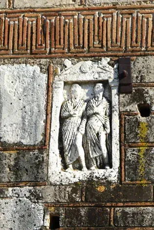
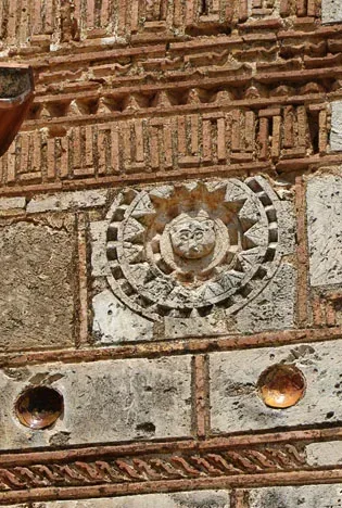
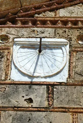
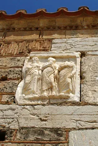
On the inside, extensive wall painting damage has been inflicted upon the church, possibly due to candle use, rendering them blurred or blackened. There is so much this conjecture that a possible fire blow might have been held responsible for this damage, however there is no witness to support this case.
Despite that, the Assumption of Virgin Mary Church is considered of the most significant Byzantine temples-monuments not only of the area it is located but of the whole country as well.
Geographical Coordinates
The Church of the Assumption of Virgin Mary (Agia Triada)
- Google Map
- 37.63461621967628, 22.80279615570879
The Church of the Assumption of Virgin Mary (region of Plataniti)
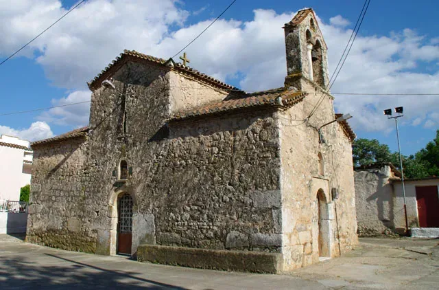
Built in the 12th century AD, it is also a cruciform church. The date’s approximation is suggested following the resemblance born of this church to the one in the region of Agia Triada as well as that of “Ireo”.
It can be observed that the church’s brickwork has practiced the use of ancient construction materials, while the west side wall has suffered a fissure. (Possibly the aftermath of an earthquake.)
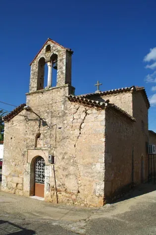
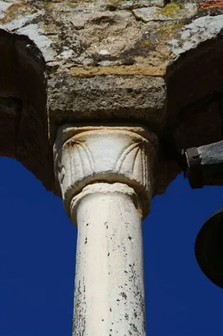
The coating on the walls’ interior quickly prohibits the possibility of exploring mural painting, which could have been saved throughout its lifetime.
The location of this Church is in the village’s central square, on its left being the route connecting two nearby villages, “Agia Triada” and “Anyfi”.
Geographical Coordinates
Platanitis 210 55
- Google Map
- 37.64938845623189, 22.796450085418996
The Church of the Transfiguration of the Christ (Plataniti)
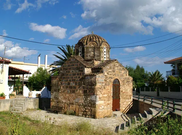
Part of the greatest Byzantine monuments across Greece, this church stands at the edge of the route connecting the region of “Plataniti” with that of “Anyfi” awaiting the visitors’ admiration and respect.
It is a single-spaced, cross-shaped, domed church, which has also practiced ancient construction material, easily discerned, since there has been no coating on the outside, whatsoever.
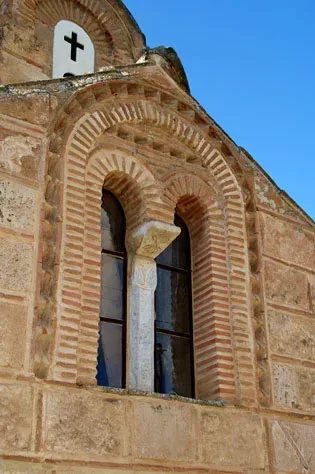
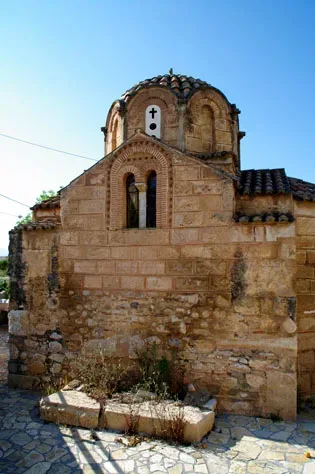
The fully-frescoed interior has probably been created in much later years and has sustained considerable damage, rendering the wall paintings barely distinguishable. The church’s assembly can be chronologically placed somewhere around the late 11th or early 12th century AD.
The bilobe windows of the temple encased by a constant sun-dried brick arch and a ceramic line are also worth noticing. What is more, the eight angle-shaped Athenian style dome is a sight hard not to admire.
There have been conscious efforts towards the church’s reformation some years ago, yet, they have never been accomplished.
Geographical Coordinates
Platanitis 210 55
- Google Map
- 37.65137692035118, 22.796260964189834
The Catholic Church of Metamorphosis Tou Sotiros
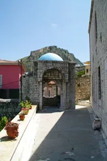
Climbing the steps from Potamianou Street, from Aghios Spiridon Square, we reach the Catholic church, which has become known as ‘Frankoklisia’. The age-old history of this church probably began during the time of the Frankish occupation, when the church must have been used as a convent for Franciscan nuns.
Shortly before the outbreak of the Greek revolution, when Nauplion was still under Turkish control, the widow of the Aga-Pasha, Fatme, restored the church, which had fallen into disrepair, in memory of her husband.
Indeed, even today, the church still maintains the appearance of a mosque, as much on the exterior, with its heavy proportions, as on the inside where there are niches for the Koran, the so-called michrab.
In 1839, King Otto gave the church to the Catholic Church, to provide for Greek Catholics and for the foreign Philhellenes, who helped Greece in her struggle for liberation; and also for the Bavarian soldiers who belonged to his escort.
It was Otto’s decision that the church be dedicated to the transfiguration of the saviour, to commemorate the metamorphosis of Greece after its liberation from the Turkish yoke. After repairs, the church was officially opened in 1840.
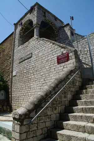
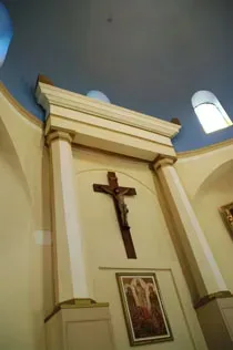
As regards the interior of the church, there are two points worthy of note: the Apse of the Philhellenes and picture of the Holy Family.
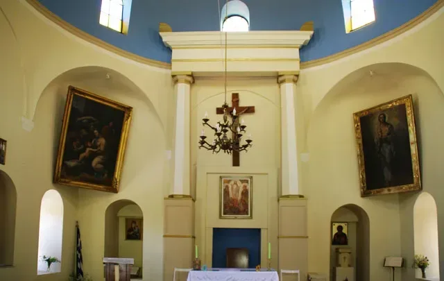
The simple wooden apse, donated by the French officer and passionate Philhellene, August Ilarion Touret, decorates the interior of the entrance to the church, and dates from 1841.
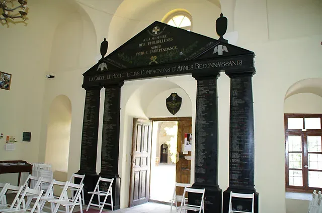
The apse, which has become known as the Touret Apse, is made of pine and is in the form of the façade of an ancient Greek temple, a well-known characteristic of neo-classical funeral monuments. On the columns, written in white, are the names of foreign Philhellenes and the places where they fell; while on the gable there are the shield and crown of Otto, inside the cross which was the standard of the fighters.
The church is also decorated by a large painting depicting the Holy Family, a copy of the work by the great renaissance painter, Raphael. The painting was donated to the church in 1843 by Philip, King of France.
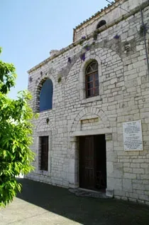
Outside the church there is an underground crypt, recently renovated, which held the remains of Philhellenes and the Bavarian soldiers in Otto’s escort, who had died during the typhoid epidemic of 1833 and 1834, and who had originally been buried in the old graveyard, near to the church of Aghii Pantes. It should be noted that the Catholic church has been in continuous operation from 1839 to the present day. The exact location of the Metamorphosis Tou Sotiros Catholic Church can be found below.
Geographical Coordinates
Catholic Church of Metamorphosis, Nafplio
- Google Map
- 37.56610382919832, 22.798203393604105
The Monastery of “Talantiou”, Old-New (Arachnaio)
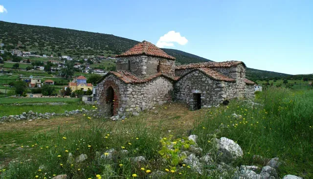
In a distance of 30 km away from the city of Nafplio, built between the mountain range of “Trapezona” and the “Arachnaio” mountain, lies the village, else called “Heli”.
The first, the oldest “Katholikon” of the Monastery of “Talantiou” is the holy church of “the Assumption of Virgin Mary”, with a chapel next to it, situated on the east corner of the village, after the crossroads connecting “Arachnaio” with another region, that of “Lygourio”.
The Church is made of stone, is cruciformed and has a square dome. The only entrance to the sanctuary is on the west side and the decoration is covered in tiles and plastic with a serrated line encompassing the arch, leading its way up to the entrance.
The church’s interior does credit to the works of the 16th century Cretan School, even if the frescoes themselves are not very well preserved.
No dedicatory sign has been salvaged, however the stonework and the untouched murals indicate that it must have been built somewhere within the Byzantine times. It is only possible that the dome has been constructed in much later years.
The chapel, annexed next to the Church, has retained a wall painting dedicated to a saint, signed A.K, probably commemorating “Agia Kyriaki”. (“Agia” is the Greek definition for a saint). It is still a mystery that the residents of the village “Heli” still address it as “Agia Marina”, another saint’s name.
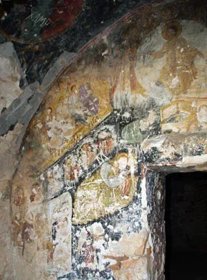
It was in 1761 that the monks decided to change their place of worship to a New Monastery, with the Superior Father “Heliotis Grigorios Koukiniotis” personally attending and undertaking its erection. According to the dedicatory sign, in 1841, the whole north side of the church was renovated.
The New Monastery was incorporated in 1892 with the Abbeys of “Agnountos” and “Gabriel and Michael” for a long period of ten years. The year 1933 saw another merger with the Nunnery of “Karakala”. Based on the testimonies of the villagers, the Monastrey remained operational till WWII, caring for the blind of the community.
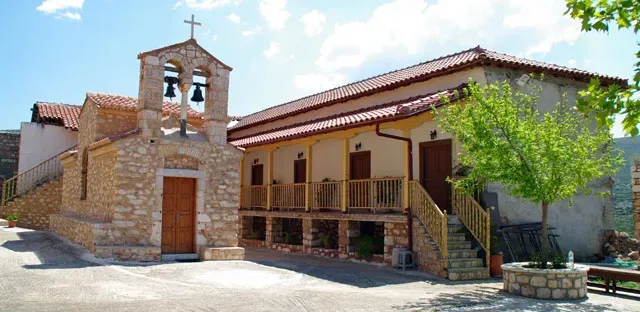
Architecturally, the “Katholikon” is centre-staged in the Monastery, following a cruciformed shape with a hemispherical arch deep within the sanctuary.
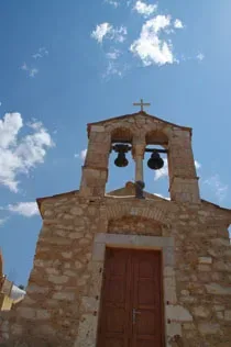
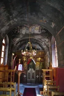
The church’s interior is teeming with frescoes, with the artist’s name remaining unknown. The west side of the church carries a bilobed bell tower.
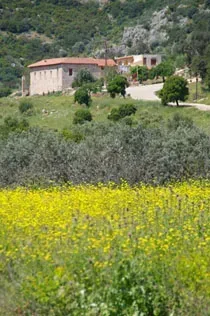
There are efforts, especially by the Nunnery of “Karakalas” to the restoration of the Monastery as well as its visiting attendance.
Geographical Coordinates
Epar.Od. Metochion – Arachneiou, Midea 210 55
- Google Map (old monastery)
- 37.67515721067373, 22.962246146260725
- Google Map (new monastery)
- 37.673048406273686, 22.91418379561093