Welcome to the amazing world of the archaeological sites of the Municipality of Nafplion.
Here, history coexists with nature, creating something unique at each site for exploration and discovery. Indulge in the magic of the past and discover culture and history through these archaeological treasures.
By visiting the archaeological sites of Nafplio, you will discover a world full of history, culture and magic. Visiting the archaeological sites is an opportunity to explore history, enjoy nature and enrich your spiritual experience.
Ancient Assini – Kastraki
Kastraki or Citadel of Ancient Assini, next to Tolo, on a hill – cape of 52m and a length of 330 m.

From the 5th millennium BC up to about 600 AC, the citadel was continuously inhabited, but the first citation to Assini was made by Homer (B 560), indicating that Argos , Tiryns , Epidaurus and other cities of Argolida participated in the Trojan war with a large number of ships ( eighty ships) .
The first excavations of the Acropolis and Lower Town were accomplished by the Swedish Archaeological Expedition (1922-1930) and continued in the 1970s by D Conservation Unity of Prehistoric and Classical Antiquity and the Swedish Institute in Athens.

The construction of surviving the Acropolis walls until today dated possibly during 300 BC by the King of Macedonia, Demetrius “The Besieger”. They have two main entrances – gates. The main gate is conveniently located on the north side, while the secondary on the east. The wall was repaired during both the Early Byzantine Period, and during the second Venetian Occupation. Furthermore, during the Italian Occupation, fortifications were erected on the Acropolis.
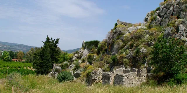
The life cycle of the Acropolis is directly interwoven with the surrounding area and in particular with the position “Hill Barbuna.”, which was a large Mycenaean cemetery. In the graves many offerings were found, which reinforces the view that Assini communicated with the cities of the Aegean, Crete and probably Cyprus. The discovery of shipwrecks of Mycenaean era at Iria (area near Assini) confirms the previous speculation.
The Late Geometric period found (8th century BC) Assini flourishing, developing trade with Athens, Cyclades and southern Peloponnese. During the next century, the decline of Assini begins, which will last several centuries and the inhabitants migrate to Assini of Messinia (Koroni). In the 3rd century, a period of Assini’s recovery commences. The excavation efforts have revealed valuable findings that era, such as tanks, houses, mill etc.
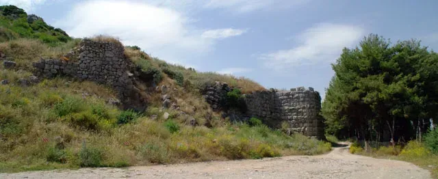
The dwelling of the Acropolis continued certainly until about the 7th century AD, as finds in the Lower Town certify the existence of life these centuries.
At the archaeological excavations of the Lower City is a small chapel dedicated to the Virgin Mary.
Many of the finds from the excavations of Assini are on display in Sweden museums particularly from the excavations of 1920, while others exhibited in the Archaeological Museum of Nafplio.
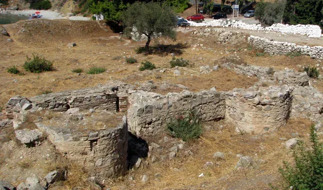
Finally, it should be noted that among other findings, there was a Mycenaean clay head called the “King of Assini.” The statue was the inspiration for Nobel laureate poet George Seferis creating the poem, which made Assini globally famous.
“Assinin te … Assinin te … “
Geographical Coordinates
Epar. Od. Lefkakia – Tolo, Asini, Nafplio
- Google Map
- 37.52883537818071, 22.875952840679002
For more information: EFA. Argolida, Syntagma Square, Tel: +30 27520 22657, e-mail: [email protected]
Archaeological Site of Tiryns
Historical background
The low hill of Tirynth, in the 8th kilometer of road Argos-Nafplio, was continuously inhabited from the Neolithic Age to Late Antiquity. In prehistoric times, the area flourished mainly during the early and late Bronze Age.
In the second phase of the EH era (2700-2200 BC) a major centre with dense population and a unique construction circular building, 27 meters in diameter, must have been here on top of the hill.
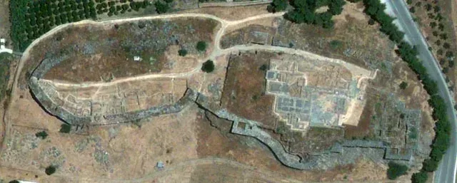
During the Late Bronze Age, Tiryns fortified hill gradually and surrounds within the “Cyclopean” walls of the palace complex and other buildings used primarily by the ruling class as places of worship, warehouses and workshops as well as residences. In historical times, Tiryns, although it should have been in the form of an organized political community, could not compete with Argos, which destroyed it, in the first half of the 5th century, exiling its inhabitants.
Pausanias, who visited Tiryns the 2nd century AD, found it deserted. During the Byzantine era in Upper Acropolis a funerary temple was founded and possibly a small class settlement in the west of the Acropolis. The end of the small longer settlement must be connected with the conquest of Argos from the Turks in 1379 AD. In Venetian sources, Tirynth was referred to as Napoli vecchio, while the name Tirynth was given again in the modern era replacing the usual name “Paleocastro.(old castle)”.
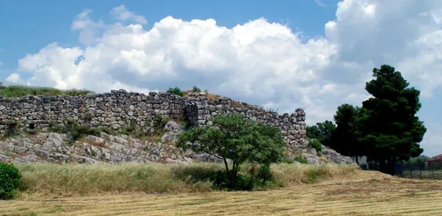
The investigations of the German Archaeological Institute and the Greek Archaeological Service from 1876 to present times, have unearthed major Mycenaean citadels, tracking stages of the culture of prehistoric and historic periods of Argolida prefecture. After the pioneers Heinrich Schliemann and Wilhelm Dorpfeld (1884-1885), the area was investigated in the first half of the twentieth century, by Georg Karo and Kurt Müller.
In the late 1950s, the Curator of Antiquities of Argolidos, Verdelis Nikolaos, undertook the restoration project on the west side of the fortifications which had collapsed and covered by the debris of old excavations. After 1967, the excavations conferred again in German Archaeological Institute, under the supervision of Ulf Jantzen, Jörg Schofer, Klaus Kilian and Joseph Maran continual research, including the Lower Citadel and the Lower City. At the same time, excavations are undertaken by the local Conservation Unity of Antiquity both at visited archaeological sites and regions.
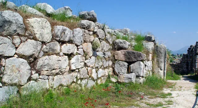
The discovery of the excavations of a monument protected for centuries under the soil and long-term exposure without maintenance care to weather conditions and the actions of visitors caused significant damage to the archaeological site.
Through actions of D Conservation Unit of Prehistoric and Classical Antiquity Items, competent service of the Ministry of Culture and the direct support of the Peloponnesian Region, the monument were included in projects funded by the Second and Third Community Support Framework.
The participation of the German Archaeological Institute which funded the last decade studies of German architect Jan Martin Klessing implemented in Tirynth, was funded.
During this time, a large number of collaborators (archaeologists, designers, skilled and unskilled workers) participated in the program of upgrading one of the most important archaeological sites of the Argolida which is included in the list of monuments of world heritage of Unesco.
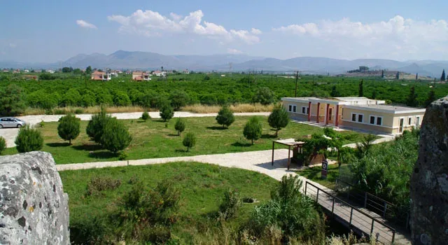
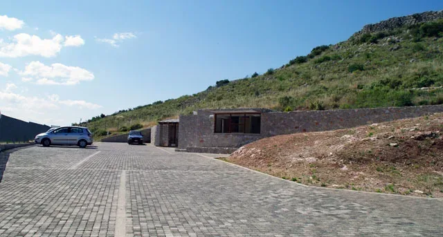
Besides the responsibility of the Directorate of Restoration of Ancient Monuments, Ministry of Culture implemented modelling works for the archaeological site, open to visit, which now includes organized routes, buildings convenience, new entrance and parking.
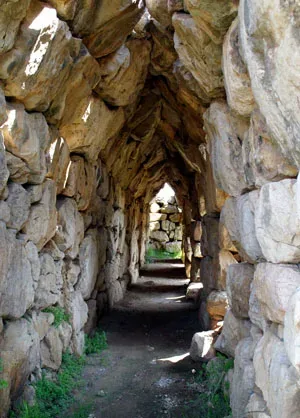
The Monuments of Area
Western Bastion
The Western Bastion is an outstanding achievement of Mycenaean architecture with a clear defensive character. The western staircase is protected by a bastion creating a sickle extension of the wall of the third phase. This section of the wall is the only one with curved outline. The maximum width is 7 m the curved section of the wall begins in the south at the height of the large yard and ends at the north tower which existed already in the second phase of the wall.
Fortification of Tirynth
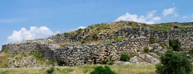
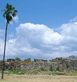
The walls bounding the citadel of Tirynth were built in three main construction phases and fortified gradually whole hill from the south-highest to lowest north-sixes. Red and gray limestone found abundant both on the same hill as the hill of Prophet Elias east of the citadel were used as a building material.
The size of the boulders which were mainly used for the walls of the third phase caused wonder and admiration to antiquity, which is directly reflected in the myth of the Cyclops. The boulders weigh several tonnes justifying the view of Pausanias (II, 25, 7-9) that neither pair of mules was able to move the smallest of them.
Lower Acropolis
On the north and lowest elevation of the hill of Tirynth, the Lower Acropolis was fortified for the first time in the early 13th century BC (HR IIIV1). The fortification was replaced in the third phase of construction of the wall in the 13th century (Late Helladic IIIB2) by a strong wall thickness up to 7 m below the natural contours of the hill and extending south to the intersection with the fortification of the Middle and Upper Acropolis.
The Lower Acropolis connected through northern extension of the runway (50) with the Upper Citadel, but it also has two of its own access. A small entrance at the bend of the western side of the wall between the middle and lower citadel which was closed with a gate as traces of the hinges on the monolith threshold evidenced, and an opening in the top of the north wall untracked for a door. This opening is protected by a guardhouse on the eastern side of the wall which was much higher than the external level and the access to it must have been made possible with portable wooden scale. On the contrary, the entrance on the west side leads to an open stone staircase.
In the second half of the 13th century BC (Late Helladic IIIB2) after the completion of the fortifications, a huge construction activity grows, destroying the interference of the remains of earlier Mycenaean periods and Middle Helladic. The lower acropolis is formed into terraces and is built with a single plan. The buildings lined up along the walls are separated from the open walkways running north-south. A main road leads from the north gate to the south of Lower Acropolis and is associated with the runway (50) leading to the Upper Citadel.
Overall, ten building complexes were investigated (buildings I-X), which served as homes and also as laboratory facilities for the processing of metals and precious materials. Similar use is witnessed for rooms inside the wall.
Geometric Church
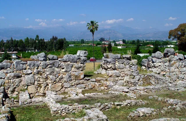
East of the gate that connects the courtyard 30 with the courtyard of the building 29 of the east wing of the palace, a pit – depositor was investigated in 1926, the so-called cesspit, which contained mainly pottery and a few metal objects. The oldest finds date back to the Late Geometric period and the newer around 650 BC, despite the fact that the majority of the offerings belong chronologically to the end of the geometric and sub-Geometric period.
The quality of the findings, include the clay shields and masks which are displayed in Museum of Nafplio, and their preservation, where most findings are crushed before disposal and bear traces of secondary combustion, arguing for its status as tributes. It is very probable that some of them were hung in a sacred space while others served for rituals probably at an altar space. The finding of the cesspit was associated for these reasons with the retrofit of the altar at the high court and with the elongated building that covers the eastern part of the great palace of the Mycenaean era.
So, it was considered that this building was a temple of the Geometric period, established at the Mycenaean Palace where people worshipped the goddess Hera. Unfortunately, the full revelation of this building ever since Schliemann period has deprived research from valuable archaeological evidence that could give a definitive answer to the still open question of the use and the dating of the building.
Dr. Alkistis Papadimitriou
Head of D Conservation Unity of Prehistoric and Classical Antiquitiy
More information about the archaeological site of Tiryns can be found on website of the Ministry of Culture and Tourism ODYSSEUS
Geographical Coordinates
Tiryns, Nafplio 211 00
- Google Map
- 37.60030833265785, 22.80133317136363
- 2752022657
For more information: EFA. Argolida, Syntagma Square, Tel: +30 27520 22657, e-mail: [email protected]
Mycenaean Acropolis of Mideas
The prominent position of Midea between Mycenaean centres of Argolida has been focusing emphasis by researchers of the Mycenaean civilization. Midea is considered as the third most important fortified Mycenaean Acropolis of Argolida, after Mycenae and Tiryns. The cyclopean fortifications, the findings of recent excavations, the position of the mythology and its connection with the extensive Mycenaean cemetery in the neighbouring Dendra, rank Midea in the major Mycenaean centres of the mainland.
The Acropolis is built on top of a conical hill at an altitude of 270 meters from the sea and 170m from the surrounding area .It is located in the middle of the distance between Mycenae and Tiryns dominating the eastern outskirts of Argolida plain. Its strategic location, with the uninterrupted view provides the ability to control the entire plain and Argolikos bay. This explains mainly the development and prosperity of Midea during the Mycenaean era.
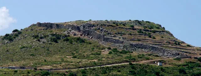
The cyclopean wall encloses an area of about 24,000 sq.m. and protects the upper Acropolis and the lower terraces northeast and northwest of the hill. The southeast side is steep and for this reason it was not fortified. The gates of the Acropolis are opposite to one another on the east and west side of the fortification.
Outside the gates, the Cyclopean fortification is another major project, used for irrigation of the Acropolis of Midea and it is similar to analogous structures at Mycenae and Tiryns. This tunnel was opened in ekforic system in the thickness of the western part of the wall, which led to an underground water source.
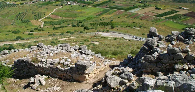
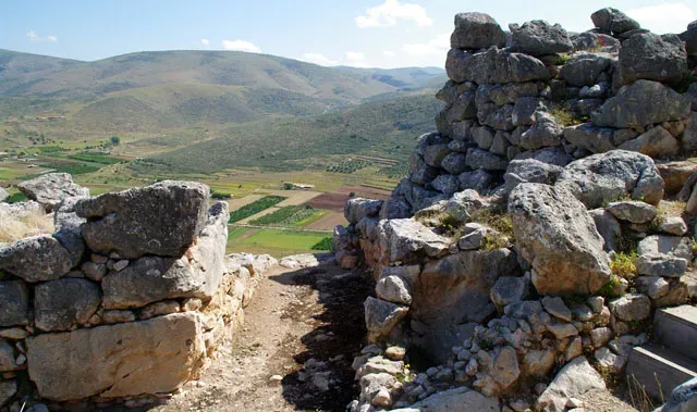
During recent excavations, areas near the East Gate and the lower terraces northeast of the Acropolis were investigated. The entrance of Eastern Gate, which takes the form of a simple opening in the wall, was purified from the fill. A cyclopean Gangways (ramp), built with boulders, leads to this gate, as to Tirynth. A second inner gate is formed between a cyclopean wall and the inner sidewall of the fortification. After the internal gate, several rooms were investigated, in contact with the wall. As demonstrated by the findings of these rooms, these were workshops and warehouses.
In the lower northeast terraces, a large rectangular building with particular significance in the form of “mansion” was revealed. It had been destroyed along with rooms near the East Gate of earthquake and fire in the late 13th century BC, as happened in neighbouring Tirynth. This earthquake caused extensive damage to the fortification and all the buildings of Acropolis. Residues of skeletons, which were found, submerged by boulders in various spots of the area, belong to the victims of this earthquake. The «palace ” was restored after the destruction and re-used during the 12th century BC.
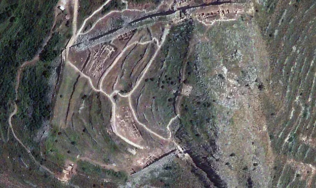
The West Gate of Acropolis was revealed throughout during recent excavations. It is formed between the tip of the south-western part of the wall and a rigid retaining wall, covering the cliff. Inside the thickness of the wall ending at the gate, an inner room is formed, which has served as an outpost and storage space, as the jars and other large vessels show.
An impressive compact bastion guarded the gate and the guardhouse. The walls of the orifice bore gate are decorated with painted plaster, as it is shown by the numerous fragments of wall paintings gathered by the depletion layer.
In the Acropolis inside the West Gate, excavations have brought to light a complex of 15 rooms built in successive terraces, parallel to the wall. It consists of two wings either side of a central corridor, crossed by a constructed pipeline.
The best preserved rooms, which seems to have been underground, located in the wing built in contact with the wall. The walls are preserved to a sufficient height and were covered with painted plaster, as indicated by fragments of frescoes found.
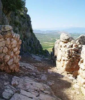
In the rooms of the complex, pottery is found in significant quantities, dating to the Late Bronze IIIB2 period, in the second half of the 13th century BC. Pottery of the figurative style, similar to those of other major centres Argoli (Mycenae, Tiryns, Berbati) was also found. There were even stone and leaden utensils and many bronze, stone and bone tools and raw pieces of semi-precious stones and he matrix of steatite for jewellery.
Other interesting findings are jewellery, such as beads of various kinds, gems, fragment of Minoan rhyton in the shape triton amethyst, broken wall, roof tiles and numerous clay figurines. A large wheeled figurine deity is of particular interest, type of the rarity separate figurines, which have been found in sanctuaries of Mycenae, Tiryns and Phylakopi of Milos. A clay seal and a storage stirrup jar with inscriptions in Linear B tablets, is also of high importance. The findings, however, show that most of the rooms of the complex were workshops and warehouses.
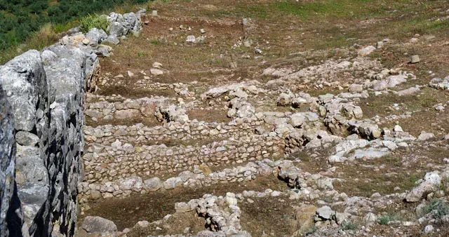
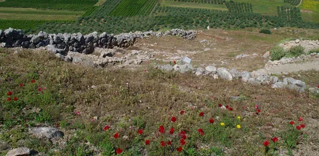
At the terrace in the south slope of Acropolis and parts of three other buildings, built on both sides of a road were revealed, which had also been destroyed by the earthquake and the strong fire of the late 13th century B.C. This area was part of the drainage system with built pipelines and underground tank.
The findings of the buildings were abundant pottery, dating to the second half of the 13th century BC , clay figurines, among which some are distinguished that which belong to large wheeled figurines of female deities , stone and metal utensils , jewellery, gems , tools and other objects that testify to the operation of specialized workshops, such as fragments of semi-precious stones and other raw materials.
A clay prism seal depicting a lion attacking a bull is a very important finding with inscriptions in Linear B tablets , in which the word “Megaron”(Mansion) is included.
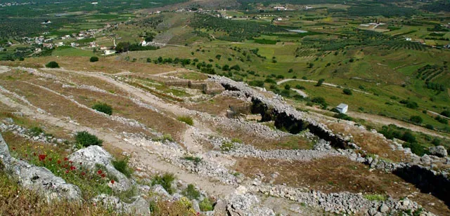
At the Terrace in the Upper Acropolis significant building remains and graves of the EH and the Middle Helladic period (3200-1600 BC) with abundant pottery were revealed, including several Neolithic shreds. These findings suggest that the settlements of before Mycenaean Period of Midea were developed on top of the hill.
The results of recent excavations, especially finding pottery and seals with inscriptions in Linear B script, indicating that Midea was alongside Mycenae and Tiryns, an administrative and economic center.
Other evidence which links Midea with these two citadels is the kind and quality of findings, which reveal important artistic and craft production, the evident connections with other centres of Argolida the Aegean and the East in general, and the worship spaces, as it is indicated by the large Wheelchairs female figurines and other religious symbols.
Dr.K. Dimakopoulou, N. Divari-Valakou
D’ Conservation Unity of Prehistoric and Classical Antiquity

Geographical Coordinates
Epar. Od. Argos – Arachnaios, Midea 210 55
- Google Map
- 37.65072963139113, 22.84313496396744
For more information: EFA. Argolida, Syntagma Square, Tel: +30 27520 22657, e-mail: [email protected]
Mycenaean Cemetery of Dendra

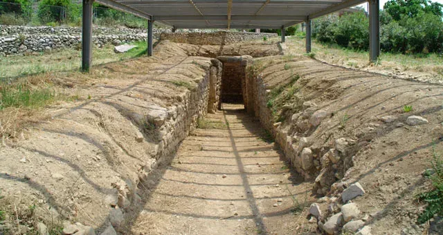
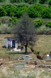
Along the Mycenaean cemetery of Dendra extends to the south-western slope of a low hill, west of the Mycenaean Acropolis of Midea. The excavated part includes a vaulted and sixteen chambered tombs.
The excavations at the site began in the spring of 1926 by Swedish archaeologist Axel W. Persson. That summer, the vaulted tomb and next year three chambered were investigated. Two more graves spanning to the Northeast and outside the boundaries of current archaeological area were investigated by N. Burton, on the autumn of 1927. Persson excavated another chamber tomb in 1937 and five others in 1939.
In 1960, the famous “Tomb of Armor”, was investigated by N. Verdelis and two other chambered tombs were investigated by the Swedish archaeologist P. Åström.
In 1977, two cambered tombs and mounds that surround them were excavated by E. Protonotariou – Deilaki
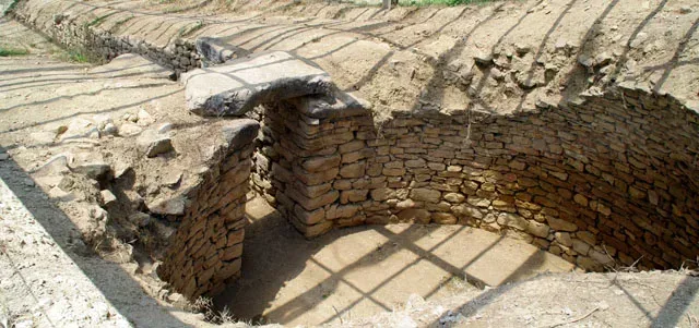
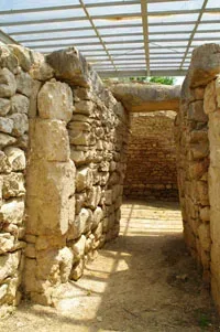
The chambered tombs were carved into the soft rock with a thick hillside. They consist of three parts: the street, the orifice and the chamber.
The tombs differ both in terms of size (the smaller is 8 and the largest almost 20 meters), and in the way that the burial chamber is configured. They have downhill routes with converging walls and quadrilateral burial chambers. The entrance is obstructed in dry stone. Plastered walls and floors, pitched or flat roof, benches and alcoves and side chambers give the impression that these tombs imitate the houses of the living.
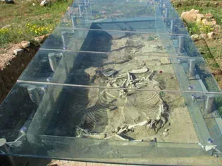
On the floor of the chambers, additional pits often were dug. The graves had been used for burials, for long periods. Important information for funerary rituals of Mycenaean Period is given to us by the tombs of three pairs of horses found in the vicinity of their graves.
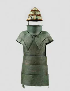
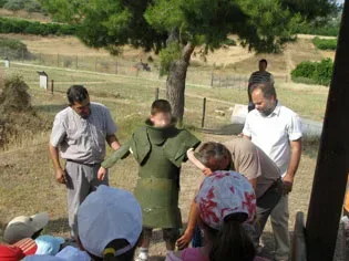
The excavation yielded many important discoveries such as jewellery, gems, weapons, tools and utensils of gold, silver, copper, alabaster glass, ivory, faience and semi-precious stones, as well as interesting pieces of pottery and figurines. However, the famous armour is the most interesting of these. The grave goods in conjunction with the construction of monumental tombs indicate a society with complex social structure.
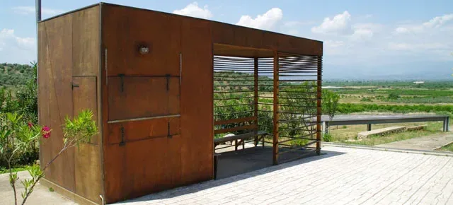
The cemetery of Dendra is one of the richest Mycenaean cemeteries Peloponnese and can be compared with the big cemeteries of Prosymna, of Diradas in Nauplia and Assini in Argolida and of Aidonion in Corinthia. As the findings confirm, it was in continuous use from 1500 to 1180 BC and it must have belonged to an important Mycenaean centre, possibly to neighbouring Midea.
The findings from the Mycenaean cemetery of Dendra are kept in the Archaeological Museum of Nafplio and at the National Archaeological Museum.
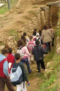
At the archaeological site, many educational programs take place by D EPCA for students of all ages. For information about educational programs please contact with D EPCA
Evangelia Pappi
Archaeologist, Ministry of Culture, D΄ ΕΠΚΑ
Geographical Coordinates
Dendra 210 55, Argolida
- Google Map
- 37.65713097921762, 22.825670720417527
For more information: EFA. Argolida, Syntagma Square, Tel: +30 27520 27502, e-mail: [email protected]